Natick
| Natick | ||
|---|---|---|
 City center |
||
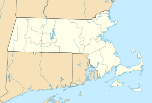
| Location in Massachusetts | ||
|
|
||
| Basic data | ||
| Foundation : | 1651 | |
| State : | United States | |
| State : | Massachusetts | |
| County : | Middlesex County | |
| Coordinates : | 42 ° 17 ′ N , 71 ° 21 ′ W | |
| Time zone : | Atlantic Standard Time ( UTC − 4 ) | |
| Residents : | 33.006 (as of 2010) | |
| Population density : | 844.1 inhabitants per km 2 | |
| Area : | 41.6 km 2 (approx. 16 mi 2 ) of which 39.1 km 2 (approx. 15 mi 2 ) are land |
|
| Height : | 55 m | |
| Postal code : | 01760 | |
| Area code : | +1 508/774 | |
| FIPS : | 25-43895 | |
| GNIS ID : | 0619407 | |
| Website : | www.natickma.gov | |
Natick is a small town in Middlesex County in the eastern state of Massachusetts . It is located 15 miles west of Boston in the Greater Boston Area.
The first Christian settlement in Natick ( place of the hills ) dates back to 1651. During the King Philip's War from 1675, most of the native Indians were resettled on a peninsula of Boston Harbor or died of colds. When Natick was officially confirmed in 1781, there were hardly any Indians left here.
Four miles of the traditional Boston Marathon run through Natick.
Also located in Natick is the so-called Combat Capabilities Development Command Soldier Center (CCDC Soldier Center), which, as the military research center of the US Army, works significantly on the development of new technologies for soldiers in crisis areas.
The headquarters of The MathWorks and Cognex are located in the city.
Sons and daughters of the place
- John Carlson (born 1990), ice hockey player
- Al Parker (1952-1992), film director
- Jonathan Richman (born 1951), rock musician
- Philip W. Schiller (* 1960), manager
- Pete Smith (born 1940), baseball player
- Marc Terenzi (* 1978), pop singer
- Alexander Wheelock Thayer (1817–1897), Beethoven biographer
Individual evidence
- ^ US Army Combat Capabilities Development Command: CCDC Soldier Center. In: US Army . February 4, 2019, Retrieved May 20, 2019 (American English).

