Arlington, Massachusetts
| Arlington | ||
|---|---|---|
 The water tower in Arlington Heights, built in 1921 |
||
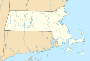
| Location in Massachusetts | ||
|
|
||
| Basic data | ||
| Foundation : | 1635 | |
| State : | United States | |
| State : | Massachusetts | |
| County : | Middlesex County | |
| Coordinates : | 42 ° 25 ′ N , 71 ° 9 ′ W | |
| Time zone : | Eastern ( UTC − 5 / −4 ) | |
| Residents : | 42,844 (as of 2010) | |
| Population density : | 3,197.3 inhabitants per km 2 | |
| Area : | 14.3 km 2 (about 6 mi 2 ) of which 13.4 km 2 (about 5 mi 2 ) is land |
|
| Height : | 14 m | |
| Postcodes : | 02474, 02475, 02476 | |
| Area code : | +1 339/781 | |
| FIPS : | 25-01605 | |
| GNIS ID : | 619393 | |
| Website : | www.arlingtonma.gov | |
Arlington is a place in Middlesex County , in the state of Massachusetts in the United States . In 2010 the population was 42,844.
Arlington is a neighboring town of Cambridge and is 10 kilometers northwest of Boston .
Geographical location
Arlington is 14 km², of which 1.2 km² is water. In Arlington, you'll find Spy Pond, Mystic Lake, Mystic River , Alewife Brook, Arlington Reservoir, Mill Brook, and Hills Pond.
Districts
- Arlington Center
- Arlington Heights
- East Arlington
- Brattle Square
- Jason Heights
- Arlmont Village
- Morningside
- Turkey Hill
The neighboring towns of Medford , Lexington , Winchester , Cambridge , Somerville and Belmont border Arlington .
education
The Arlington Public Schools are nine public schools in Arlington. The seven elementary schools are Brackett, Bishop, Thompson, Hardy, Peirce, Stratton, and Dallin. There is a middle school and a high school, which are Ottoson Middle School and Arlington High School.
sons and daughters of the town
- June Caprice (1895–1936), actress
- John Lyons (1900–1971), ice hockey player
- John Lax (1911-2001), ice hockey player
- Robert Creeley (1926–2005), poet and book author
- Whitney Smith (1940-2016), flag expert
- Richard Gerard Lennon (1947–2019), Roman Catholic clergyman, Bishop of Cleveland
- David Armstrong (1954-2014), photographer
- Lawrence Watt-Evans (born 1954), writer
- Holly Flanders (* 1957), ski racer
- Katy Grannan (* 1969), photographer
- Tom Walsh (born 1983), ice hockey player


