Chestnut Hill, Massachusetts
|
|
This article was on the basis of substantive defects quality assurance side of the project USA entered. Help bring the quality of this article to an acceptable level and take part in the discussion ! A closer description on the resolving issues is missing. |
| Chestnut Hill | ||
|---|---|---|
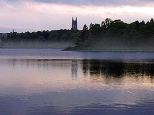
 Boston College and the Chestnut Hill Reservoir |
||
| Location in Massachusetts | ||
|
|
||
| Basic data | ||
| State : | United States | |
| State : | Massachusetts | |
| Counties : |
Norfolk County Suffolk County Middlesex County |
|
| Coordinates : | 42 ° 20 ′ N , 71 ° 10 ′ W | |
| Time zone : | Eastern ( UTC − 5 / −4 ) | |
| Height : | 60 m | |
| Postal code : | 02467 | |
| FIPS : | 25-13625 | |
| GNIS ID : | 612301 | |
Chestnut Hill is an affluent suburb ( village ) six miles (10 km) west of downtown Boston in the state of Massachusetts in the United States . Like all suburbs in Massachusetts, Chestnut Hill was not incorporated. It consists of parts of three separate parishes , all of which are in different counties : Brookline in Norfolk County , Boston in Suffolk County, and Newton in Middlesex County . The boundaries of Chestnut Hill are roughly defined by the Chestnut Hill, MA 02467 zip code region . The name is less a topographical feature than a collection of smaller hills that tower above the 546,000 square meter Chestnut Hill Reservoir . Chestnut Hill is best known as the site of Boston College and as part of the Boston Marathon route . The well-known architect Frederick Law Olmsted was also creative in the area.
Personalities
- Robert Kraft , owner of the New England Patriots
- Mary Baker Eddy , founder of the Christian Science Church in Newton
- Reginald Fessenden , called the father of broadcast radio ; the Reginald A. Fessenden House in Chestnut Hill (Newton) is a recognized national historical site and is also in the National Register of Historic Places
- Theo Epstein , general manager of the Chicago Cubs
- Terry Francona , manager of the Cleveland Indians
- Alice Hathaway Lee Roosevelt , first wife of Theodore Roosevelt and mother of Alice Roosevelt Longworth
- Louis K. Liggett , drugstore magnate from Newton
- Leverett Saltonstall , Massachusetts Governor 1939-1945 and Senator 1945-1967


