Fort Point (Boston)
Fort Point is a district ( Neighborhood ) of Boston in the state of Massachusetts of the United States . The district was named after the fortification Fort Hill , which was used to secure the city in colonial times.
history
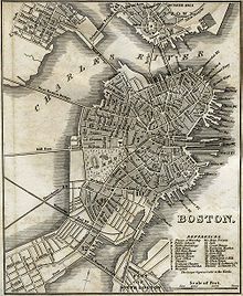
The Fort Hill was located near the present-day intersection of Oliver and High . At least until 1675 (see map ) the hill protruded into the Atlantic , which is where the English name "Point" comes from. Its height and proximity to the sea made the hill a privileged place for the construction of defenses and especially for the installation of defensive cannons .
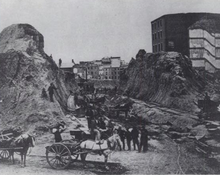
Between 1866 and 1872, the city of Boston sought to gain more land for commercial parks. One project was to remove the hill, widen the streets and add heights to all buildings.
Today the area is flat and is mostly occupied by the office towers of One International Place . By Landaufschüttung the coastline could be moved outward so that the site of the old fort no longer directly on the coast of today Boston Harbor is located.
Fort Point today
The boundaries of today's Fort Point district are not clearly defined. At its widest point, the district comprises a few blocks on both sides of the Fort Point Channel , which is much narrower today than it was in colonial times due to the landfill. The Fort Point Arts Community is on the opposite side of the canal. This area is also known as the South Boston Waterfront or Seaport District . Some real estate agents operate buildings at Fort Points , which are east of the canal and west of the Boston Convention and Exhibition Center and the Seaport Hotel and Seaport World Trade Center . South Boston begins south of it . The Boston Redevelopment Authority describes the extent of Fort Point as "an area of approximately 100 acres (0.4 km²) within South Boston , which is to the west by the Fort Point Channel , to the north by Summer Street , to the east by Bypass Road and is defined in the south by 2nd Street . "
On the Summer Street Bridge that spans the canal , a sign greets visitors heading east in South Boston and those heading west in Fort Point . The USPS shipping center is located between the canal and Boston South Station . To the northwest is Chinatown , and on the east side of the canal, Fort Point intersects with the Financial District .
In 2001, an application was made to the Boston Landmarks Commission to register Fort Point as a landmark . The first guidelines were drafted in 2007, and in December 2008 the Mayor Thomas Menino and the Commission agreed to accept these guidelines. On January 28, 2009, they were officially recognized by the Boston City Council , making Fort Point an officially registered landmark.
reception
The district was used as a filming location in the 2006 film Departed by Martin Scorsese . An avenue between Thompson Place and Farnsworth Street served as the location for the fictional address "344 Wash" used in the film. In addition, some city views of downtown were shot from the rooftops at Fort Point .
Individual evidence
- ^ Boston City Council (ed.): Documents of the City of Boston . tape 1 . JH Eastburn, Boston, MA 1867, OCLC 659327717 , p. 19 ( online in Google Book Search).
- ^ Helen Weston Henderson: A loiterer in New England . George H. Doran Company, New York City 1919, OCLC 1082790 , p. 346 ( online in Google Book Search).
- ↑ Fort Point Arts Community website. Retrieved May 7, 2012 .
- ↑ Planning Initiatives. (No longer available online.) Boston Redevelopment Authority, archived from the original on February 19, 2007 ; accessed on May 7, 2012 (English). Info: The archive link was inserted automatically and has not yet been checked. Please check the original and archive link according to the instructions and then remove this notice.
- ↑ Steve Hollinger, Todd Gieg: Boston's Fort Point District. A Landmark of New England's Maritime and Industrial Past. In: SAND News. March 27, 2001, accessed May 7, 2012 .
- ^ Fort Point Channel. City of Boston, accessed May 7, 2012 .
- ↑ Michelle Hillman: Fort Point designated as landmark. In: Boston Business Journal . February 6, 2009, accessed May 7, 2012 .
Web links
Coordinates: 42 ° 20 '54.6 " N , 71 ° 3' 1.3" W.


