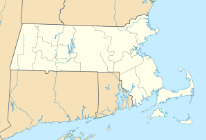
Belmont, Massachusetts
| Belmont | ||
|---|---|---|
 town hall |
||
| Location in Massachusetts | ||
|
|
||
| Basic data | ||
| Foundation : | 1859 | |
| State : | United States | |
| State : | Massachusetts | |
| County : | Middlesex County | |
| Coordinates : | 42 ° 24 ′ N , 71 ° 11 ′ W | |
| Time zone : | Eastern ( UTC − 5 / −4 ) | |
| Residents : | 24,729 (as of 2010) | |
| Population density : | 2,027 inhabitants per km 2 | |
| Area : | 12.2 km 2 (approx. 5 mi 2 ) | |
| Height : | 15 m | |
| Postal code : | 02478 | |
| Area code : | +1 617, 857 | |
| FIPS : | 25-05105 | |
| GNIS ID : | 612147 | |
| Website : | www.town.belmont.ma.us | |
Belmont is a small suburb of Boston ( United States ) in Middlesex County from Massachusetts . The place borders on Cambridge to the west . Other neighboring towns are Arlington , Lexington , Waltham and Watertown . The entire urban area has been built on since around 1940, and the number of inhabitants has fluctuated around 25,000 since then.
Industry and commerce
Belmont is primarily a living and sleeping village with no industry worth mentioning.
environment
Due to the old building structure and the lead-containing wall paint used at the time, most of the houses in Belmont are contaminated with lead. Small children should not live in such apartments, the landlord is obliged to partially renovate them if a small child suddenly lives there. The landlord can prove that the lead paint has been painted over with a "de-leading certificate".
Infrastructure
From the one-time connection to long-distance rail traffic, one line of the Boston public transport company remains. Belmont is a stop on the Boston – Fitchburg local line , approximately 50 km east of where the line ends. Belmont has no connection to the Boston subway network, the terminus of the Red Line ("Alewife") is less than 1 km west in Cambridge. However, several bus routes connect Belmont to the Harvard Square stop.
Sons and daughters
- Thomas Vose Daily (1927-2017), Roman Catholic minister, Bishop of Brooklyn

