Oak holes
|
Eichenlöhlein (Worzeldorf)
City of Nuremberg
Coordinates: 49 ° 22 ′ 1 ″ N , 11 ° 4 ′ 55 ″ E
|
|
|---|---|
| Height : | 310-320 m above sea level NN |
| Postal code : | 90455 |
| Area code : | 0911 |
|
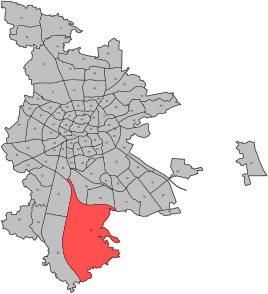
Location of the statistical district 49 Kornburg, Worzeldorf
|
|
|
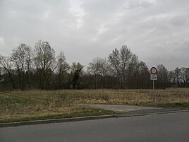
Gaulnhofer Graben near Eichenlöhlein
|
|
Eichenlöhlein (in der Au) is the name of a parcel near Worzeldorf , has the zip code 90455 and belongs to the statistical district 49 ( Kornburg, Worzeldorf ).
location
The Eichenlöhlein is 9 km south of the city center of Nuremberg on the Gaulnhofener Graben . It is partly on the districts of Worzeldorf and Kornburg . From the 1980s onwards, a new building area with partly open development was built there. This new district is located on the Kornburgerweegaecker parcel , was formerly called Eichenlöhlein in der Au and is now part of the urban development measure Nuremberg-Herpersdorf according to the legally binding development plan No. 4502 Eichenlöhlein residential area.
Archaeological digs
From 2001 to 2005 archaeological excavations were repeatedly carried out in the area north and east of the Eichenlöhlein . Extensive knowledge about the historical significance of the area was gained both in large-scale excavations and in smaller private properties. Two areas are designated as ground monuments . The northern one was over six hectares (D-5-6632-0127) and contained traces of settlement from the Urnfield Period and the Latène Period; the eastern one (D-5-6632-0128) covered five hectares and had settlement remains from the Urnfield period. Further undisturbed find horizons are most likely not to be expected there today. The excavation campaigns came to a standstill and more than 90% of the entire site has now been overbuilt in a modern way.
literature
- Hans Bosch: Essay on the settlement history in the south of Nuremberg

