Worzeldorf
|
Worzeldorf
Statistical District 493 City of Nuremberg
Coordinates: 49 ° 22 ′ 11 ″ N , 11 ° 5 ′ 49 ″ E
|
|
|---|---|
| Height : | 339 (332-352) m |
| Area : | 14.8 ha |
| Residents : | 1464 (Dec. 31, 2005) |
| Population density : | 9,892 inhabitants / km² |
| Incorporation : | July 1, 1972 |
| Postal code : | 90455 |
| Area code : | 0911 |
|
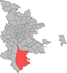
Location of the statistical district 49 Kornburg, Worzeldorf
|
|
|
View of the southwestern outskirts
|
|
Worzeldorf was an independent municipality until 1972 and has been a district of Nuremberg since then , the name of the district 3479, part of the statistical district 49 and the zip code district 90455.
Biking, hiking and riding trails lead through the village to Herpersdorf , another district of Nuremberg. The Max Beckmann School and a restaurant are located in the village.
history
The hamlet of Worzeldorf already existed with three or four farmsteads in the 11th century and in the 12th century developed into a street village on the important trade route from Nuremberg to Roth and Weißenburg , the so-called Venetian Street as a farmstead and horse changing station. In 1250 Worzeldorf was in the possession of Emperor Ludwig IV , who pledged it to the patrician Konrad Groß . From 1471 to 1806, the area was mostly owned by the Nuremberg patricians, despite the turmoil of the Margrave Wars and the Thirty Years' War . In 1449, however, their prerogative to break Worzeldorfer sandstone was one of the reasons for war put forward by Margrave Albrecht Achilles against the city of Nuremberg. In 1806 the place with Pillenreuth fell to the Kingdom of Bavaria . From 1808 Worzeldorf formed a tax district with Gaulnhofen , Herpersdorf , Königshof , Pillenreuth, Steinbrüchlein and Weiherhaus and from 1818 a municipality . However, Worzeldorf only gained significant economic importance from 1840 with the construction of the Ludwig-Danube-Main Canal and the listed grounds for cargo handling , which opened up cheap transport options to the nearby quarries .
In the Second World War was during the Battle of Nuremberg at the canal bridge at the former lock 67 an American border guards briefly. On July 1, 1972, Worzeldorf was incorporated into Nuremberg as part of the municipal reform. At the time of incorporation, Worzeldorf consisted of the districts Worzeldorf, Herpersdorf, Weiherhaus, Gaulnhofen, Pillenreuth, Königshof, Roter Bühl and Eichenlöhlein .
The busy state road St 2406 runs through the village . At Worzeldorfer Berg, a quarry is still managed every other year , the so-called Holstein quarry .
The abandoned canals and quarries are used for recreation by riders, walkers, mountain bikers and as a children's playground. Numerous buildings in Nuremberg and the surrounding area are built with Worzeldorfer sandstone.
literature
- Johann Kaspar Bundschuh : Worzeldorf, Wotzeldorf . In: Geographical Statistical-Topographical Lexicon of Franconia . tape 6 : V-Z . Verlag der Stettinische Buchhandlung, Ulm 1804, DNB 790364328 , OCLC 833753116 , Sp. 295 ( digitized version ).
- Johann Kaspar Bundschuh : Wurzeldorf . In: Geographical Statistical-Topographical Lexicon of Franconia . tape 6 : V-Z . Verlag der Stettinische Buchhandlung, Ulm 1804, DNB 790364328 , OCLC 833753116 , Sp. 972 ( digitized version ).
- Friedrich Eigler : Schwabach (= Historical Atlas of Bavaria, part of Franconia . I, 28). Michael Laßleben, Kallmünz 1990, ISBN 3-7696-9941-6 , p. 434, 489 .
- Günther P. Fehring , Anton Ress , Wilhelm Schwemmer: The city of Nuremberg (= Bavarian art monuments . Volume 10 ). 2nd Edition. Deutscher Kunstverlag, Munich 1977, ISBN 3-422-00550-1 , p. 489 .
- Hermann Rusam: Worzeldorf . In: Michael Diefenbacher , Rudolf Endres (Hrsg.): Stadtlexikon Nürnberg . 2nd, improved edition. W. Tümmels Verlag, Nuremberg 2000, ISBN 3-921590-69-8 , p. 1203 f . ( online ).
- Willi Ulsamer (Ed.): 100 Years of the Schwabach District (1862–1962). A home book . Schwabach 1964, DNB 984880232 , p. 655-669 .
Web links
- Worzeldorf in the location database of the Bayerische Landesbibliothek Online . Bayerische Staatsbibliothek, accessed on September 26, 2019.
- Worzeldorf in the Topographia Franconiae of the University of Würzburg , accessed on September 26, 2019.
- Worzeldorf in the historical directory of the Association for Computer Genealogy , accessed on September 26, 2019
Individual evidence
- ↑ Nuremberg city builder 1460-75 with notes
- ^ Wilhelm Volkert (ed.): Handbook of Bavarian offices, communities and courts 1799–1980 . CH Beck, Munich 1983, ISBN 3-406-09669-7 , p. 602 .
- ^ City of Nuremberg, Office for Urban Research and Statistics for Nuremberg and Fürth (ed.): Statistical Yearbook of the City of Nuremberg 2016 . December 2015, ISSN 0944-1514 , 18 Statistical City Districts and Districts, p. 19-20 , p. 20 ( nuernberg.de [PDF; 6.3 MB ; accessed on November 1, 2017]).
- ^ Bürgererverein Nürnberg-Worzeldorf eV statutes


