Steinplatte (Nuremberg)
|
Steinplatte
Statistical District 903 City of Nuremberg
Coordinates: 49 ° 26 '48 " N , 11 ° 3' 32" E
|
|
|---|---|
| Height : | 315 m above sea level NN |
| Incorporation : | 1899 |
| Postal code : | 90491 |
| Area code : | 0911 |
|
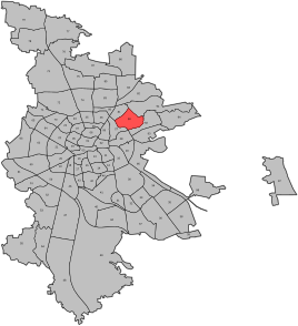
Location of the statistical district 90 St. Jobst in Nuremberg
|
|
|
Brothers Grimm School in Nuremberg
|
|
Steinplatte is both a part of the Nuremberg district of Erlenstegen and the name for the approximately 339 m high elevation in the northeast of the city of Nuremberg. Steinplatte is located in the statistical district 9 - eastern outer city in the statistical district 90 (St. Jobst). The place was incorporated into Nuremberg as part of Erlenstegens in 1899.
location
Steinplatte lies between the Rechenberg and the Platnersberg , about 4 km northeast of the center of Nuremberg.
schools
- Grim School
- Rudolf Steiner School Nuremberg
Street directory
- On a slope
- Bad Bernecker Strasse
- Bülowstrasse
- Ewaldstrasse
- Garden path
- Gneisenaustrasse
- Hauffstrasse
- Hohenlohestrasse
- Klopstockstrasse
- Kreittmayrweg
- Schlieffenstrasse
- Steinplattenweg
- Steuerwald-Landmann-Strasse
- Teutoburger Strasse
Web links
- Woxikon
- Rusam : stone slab . In: Michael Diefenbacher , Rudolf Endres (Hrsg.): Stadtlexikon Nürnberg . 2nd, improved edition. W. Tümmels Verlag, Nuremberg 2000, ISBN 3-921590-69-8 ( complete edition online ).


