Providence
| Providence | ||
|---|---|---|
| Nicknames : The Creative Capital, Beehive of Industry, The Renaissance City, The Divine City | ||
 Rhode Island State House |
||
 seal |
||
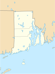
| Location in Rhode Island | ||
|
|
||
| Basic data | ||
| Foundation : | 1636 | |
| State : | United States | |
| State : | Rhode Island | |
| County : | Providence County | |
| Coordinates : | 41 ° 50 ′ N , 71 ° 25 ′ W | |
| Time zone : | Eastern ( UTC − 5 / −4 ) | |
|
Inhabitants : - Metropolitan Area : |
179,219 (as of 2016) 1,614,750 (as of 2016) |
|
| Population density : | 3,749.4 inhabitants per km 2 | |
| Area : | 53.2 km 2 (approx. 21 mi 2 ) of which 47.8 km 2 (approx. 18 mi 2 ) is land |
|
| Height : | 23 m | |
| Postcodes : | 02901 - 02912, 02918, 02919, 02940 | |
| Area code : | +1 401 | |
| FIPS : | 44-59000 | |
| GNIS ID : | 1219851 | |
| Website : | cityof.providenceri.com | |
| Mayor : | Jorge Elorza (D) | |
 Nightingale-Brown House (2012) |
||
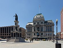
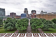
Providence is the capital of the US state Rhode Island . With around 180,000 inhabitants (2016 estimate, US Census Bureau) it is the third largest city in the New England states . The prestigious Brown University is located in Providence .
history
The city was named after God's merciful Providence by the city's founder, Roger Williams , after he and his followers were expelled from the Massachusetts Bay Colony by the Puritans in 1636 .
1975 began a redesign of the run-down inner city, which continues to this day.
Since 1984 Providence has been known worldwide as the home of Dancing Cop Tony Lepore , who controls the traffic at selected intersections by dancing.
Historical objects
- Historic Governor Henry Lippitt House is on Hope Street . The building is listed as a National Historic Landmark .

The National Park Service identifies a total of twelve National Historic Landmarks for Providence, including a Brown University building , the Nightingale Brown House and the Fleur-de-lys Studios . 166 buildings and sites in the city are listed on the National Register of Historic Places (NRHP) (as of November 11, 2018).
Population development
| year | Residents¹ |
|---|---|
| 1980 | 156,804 |
| 1990 | 160,728 |
| 2000 | 173,525 |
| 2010 | 178.038 |
| 2016 | 179.219 |
¹ 1980–2010: census results; 2016: US Census Bureau estimate
The following table shows the population development of the Metropolitan Statistical Area Providence - Warwick (states Rhode Island and Massachusetts) according to the definition of the US Census Bureau 2015:
| year | Residents¹ |
|---|---|
| 1990 | 1,509,789 |
| 2000 | 1,582,961 |
| 2010 | 1,601,200 |
| 2016 | 1,614,750 |
¹ 1990–2010: census results; 2016: US Census Bureau estimate
Demographics
According to the 2010 census, the population was 37.6 percent white and 16.0 percent African-American; 6.4 percent were of Asian origin. 29.1 percent of the population were Hispanics . The median income per household was 2,015 at 37,501 US dollars . 8.2 percent of the population lived below the poverty line.
education
Providence is home to Brown University and, immediately adjacent to its campus, the Rhode Island School of Design (RISD) with the Rhode Island School of Design Museum . Providence also has a campus of the University of Rhode Island and Johnson & Wales University , Providence College and Rhode Island College .
religion
Providence is the seat of the Roman Catholic diocese of Providence .
economy
The metropolitan area of Providence generated a gross domestic product of 80.2 billion US dollars in 2016, making it 43rd among the metropolitan areas of the United States. The unemployment rate in the metropolitan region was 3.9 percent and was thus slightly above the national average of 3.8 percent (as of May 2018). The personal per capita income was $ 49,940 in 2016, which means Providence has a slightly above average income level.
The companies Textron , Cookson Electronics (part of the Cookson Group ) and Providence Equity Partners have their headquarters in Providence .
Twin cities
-
Riga , Latvia

-
Afula , Israel

-
Florence , Italy

-
Phnom Penh , Cambodia

-
Santo Domingo , Dominican Republic

sons and daughters of the town
- Nicholas Cooke (1717–1782), politician and governor of Rhode Island
- George Hitchcock (1850-1913), painter
- Alexis Caswell Angell (1857-1932), federal judge
- Bob Olsen (1884-1956), science fiction writer
- Howard Phillips Lovecraft (1890-1937), writer
- Elizabeth Hirschfelder (1902–2002), mathematician and university professor
- John O. Pastore (1907–2000), Governor and Senator of Rhode Island
- Ruth Hussey (1911-2005), film actress
- Joseph J. Lilley (1913–1971), composer, arranger and conductor
- Bill Osmanski (1915-1996), football player
- Joe Osmanski (1917-1993), football player
- Bernard Matthew Kelly (1918-2006), Roman Catholic auxiliary bishop in Providence
- Dudley Richards (1932–1961), figure skater
- Alvin Curran (* 1938), composer
- Joan Nathan (* 1943), cookbook author
- Don D'Ammassa (* 1946), science fiction author and lexicographer
- Bruce Gertz (* 1952), jazz musician
- Shanna Moakler (* 1975), actress and playmate
- Peter Manfredo (* 1980), boxer
- Mapei (* 1983), Swedish-American musician
- Michael Parkhurst (born 1984), football player
See also
Climate table
| Providence, Rhode Island | ||||||||||||||||||||||||||||||||||||||||||||||||
|---|---|---|---|---|---|---|---|---|---|---|---|---|---|---|---|---|---|---|---|---|---|---|---|---|---|---|---|---|---|---|---|---|---|---|---|---|---|---|---|---|---|---|---|---|---|---|---|---|
| Climate diagram | ||||||||||||||||||||||||||||||||||||||||||||||||
| ||||||||||||||||||||||||||||||||||||||||||||||||
|
Monthly average temperatures and rainfall for Providence, Rhode Island
|
|||||||||||||||||||||||||||||||||||||||||||||||||||||||||||||||||||||||||||||||||||||||||||||||||||||||||||||||||||||||||||||||||||||||||||||||||||||||||||||||||||||
Web links
Individual evidence
- ↑ List of NHL by State . National Park Service , accessed November 11, 2018.
- ↑ Search mask database in the National Register Information System. National Park Service , accessed November 11, 2018.
- ↑ US Census Bureau: American FactFinder - Community Facts. Retrieved November 8, 2017 .
- ^ US Department of Commerce, BEA, Bureau of Economic Analysis: Bureau of Economic Analysis. Retrieved July 4, 2018 (American English).
- ^ Providence-Fall River-Warwick, RI-MA Economy at a Glance. Retrieved July 5, 2018 .
- ^ US Department of Commerce, BEA, Bureau of Economic Analysis: Bureau of Economic Analysis. Retrieved July 5, 2018 (American English).


