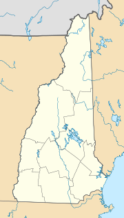
Portsmouth, New Hampshire
| Portsmouth | ||
|---|---|---|
|
Location in New Hampshire
|
||
| Basic data | ||
| Foundation : | 1630 | |
| State : | United States | |
| State : | New Hampshire | |
| County : | Rockingham County | |
| Coordinates : | 43 ° 5 ′ N , 70 ° 46 ′ W | |
| Time zone : | Eastern ( UTC − 5 / −4 ) | |
| Residents : | 20,784 (as of: 2000) | |
| Population density : | 514.5 inhabitants per km 2 | |
| Area : | 43.5 km 2 (approx. 17 mi 2 ) of which 40.4 km 2 (approx. 16 mi 2 ) is land |
|
| Height : | 6 m | |
| Postcodes : | 03801-03804 | |
| Area code : | +1 603 | |
| FIPS : | 33-62900 | |
| GNIS ID : | 0869312 | |
| Website : | www.cityofportsmouth.com | |
| Mayor : | Tom Ferrini | |
Portsmouth is a port city in the east of the US state New Hampshire and is located on a bay that forms the border with Maine . It is the largest city in Rockingham County . The city is on Interstate 95 from Boston to Portland, Maine .
history
Portsmouth was founded in 1630 under the name Piscataqua and shortly thereafter renamed Strawberry Banke . In 1653 the settlement was given city rights under its new name Portsmouth . Portsmouth was the capital of the colony of New Hampshire from 1679 to 1774. The city's naval base was the site of the 1905 Treaty of Portsmouth between Russia and Japan, negotiated by Theodore Roosevelt . The city had a tram service from 1899 to 1925 .
Population development
| year | Residents |
|---|---|
| 1980 | 26,254 |
| 1990 | 25,925 |
| 2000 | 20,784 |
| 2005 | 20,674 |
Economy and Transport
Portsmouth is home to Portsmouth International Airport at Pease .
Town twinning
Sister cities of Portsmouth are
-
 Nichinan , Japan , since 1985
 -
 Pärnu , Estonia , since 1990
 -
 East Antrim , Northern Ireland , since 1992
 -
 Severodvinsk , Russia , since 1995
 -
 Agadir , Morocco, since 1995
 -
 Kitase , Ghana, since 2004
- City friendships
sons and daughters of the town
- Benning Wentworth (1696–1770), colonial governor
- John Langdon (1741–1819), governor
- Joseph Peirce (1748–1812), politician
- James Sheafe (1755–1829), US Senator
- Charles Cutts (1769–1846), US Senator
- Fitz-John Porter (1822–1901), Army General
- Alfred Thompson Bricher (1837–1908), landscape painter from the Hudson River School
- Samuel Elliott Coues (1842–1899), historian, ornithologist, author and theosophist
- Helen Dore Boylston (1895-1984), author
- Brooke Astor (1902-2007), philanthropist
- Ilene Woods (1929-2010), singer and voice actress
- Tod Papageorge (* 1940), photographer
- Tom Rush (* 1941), folk and blues singer
- Ronnie James Dio (1942-2010), rock singer
- Michael D'Antonio (* 1955), journalist, non-fiction and screenwriter
- Charlie Kohlhase (* 1956), jazz musician
The punk band The Queers is also from Portsmouth.
swell
- ↑ 1980–2000: census results; 2005: Update of the US Census Bureau
- ↑ City of Portsmouth - Sister and Friendship Cities , accessed April 19, 2018

