Massachusetts Route 203

|
|
|---|---|
| map | |

|
|
| Basic data | |
| Overall length: | 5.18 mi (8.3 km ) |
| Opening: | Early 1970s |
| Starting point: | Jamaica Pond in Jamaica Plain |
| End point: |
|
| County: | Suffolk County |
| Important city: | Boston |
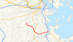
The Massachusetts Route 203 is a 5.18 mi (8.3 km ) long state highway in Boston in the state of Massachusetts of the United States with gradient from west to east. It begins in the Jamaica Plain district on Jamaica Pond and then runs southeast or eastwards over the Arborway and Parkways Morton Street and Gallivan Boulevard to its end at Neponset Circle in the Dorchester district , where it connects to US Highway 1 , the I. -93 , Massachusetts Route 3 and Massachusetts Route 3A offers.
maintenance
Before the Massachusetts Department of Transportation (MassDOT) was founded in 2009, Massachusetts Route 203 was wholly owned by the Department of Conservation and Recreation (DCR). On November 1, 2009, Msgr. William Casey Highway Overpass in Jamaica Plain , Morton Street in Mattapan and Gallivan Boulevard in Dorchester were transferred to MassDOT, while the Arborway remained under the control of the DCR.
history
The Massachusetts Route 203 was formed in the early 1970s as part of an extensive renaming or renumbering of roads surrounding the city of Boston. Most of the route was previously part of Massachusetts Route 3 , which ran south with US Highway 1 along the Jamaicaway and branched off from this in an easterly direction along today's route. At Granite Avenue , Route 3 turned south to meet the Southeast Expressway at Milton , while the non-branching route continued as Massachusetts Route 3A .
In the course of the new numbering, Route 3 was led on the Southeast Expressway into the city center, Route 3A was shortened to its current end and the former routes of Route 3 and 3A were reassembled into Route 203 . At the same time, the end of US Highway 1 was relocated so that it no longer connects to a numbered state route .
See also
Individual evidence
- ^ Road Inventory. (No longer available online.) Massachusetts Department of Transportation, archived from the original on June 20, 2012 ; accessed on October 15, 2012 . Info: The archive link was inserted automatically and has not yet been checked. Please check the original and archive link according to the instructions and then remove this notice.
- ^ Session Laws. Chapter 25. Massachusetts General Court , 2009, accessed October 15, 2012 .
- ↑ Christina Pazzanese: A big concern on two major parkways. In: The Boston Globe . September 12, 2009, accessed October 15, 2012 .
