Jamaica Pond
| Jamaica Pond | ||
|---|---|---|

|
||
| The Jamaica Pond with a boathouse, 2005 | ||
| Geographical location | Massachusetts , United States | |
| Drain | Muddy River | |
| Places on the shore | Boston | |
| Location close to the shore | Brookline | |
| Data | ||
| Coordinates | 42 ° 19 ′ 0 ″ N , 71 ° 7 ′ 13 ″ W | |
|
|
||
| surface | 28 ha | |
| Maximum depth | 16 m | |
| Middle deep | 8 m | |
| Catchment area | Charles River | |
|
particularities |
||

|
||
| Ice skating on Jamaica Pond , 1859 | ||
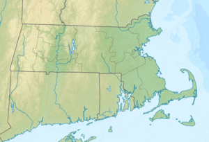
The Jamaica Pond is a kettle hole and part of the Emerald Necklace -Parksystems in Boston in the state of Massachusetts of the United States . It's located in the Jamaica Plain neighborhood near the Brookline border . The Muddy River , which later flows into the Charles River , has its source in Jamaica Pond .
The lake covers approximately 68 acres (28 hectares ) and is 53 ft (16 m ) deep in the center , making it the largest freshwater reservoir in Boston and the largest natural freshwater lake in the lower Charles River basin . It is surrounded by hiking trails and is a very popular walking, fishing, and sailing destination for Boston residents .
The lake used to serve as a drinking water reservoir for the cities of Boston and Roxbury, and it provided ice to Boston and other nearby cities in the winter.
According to the USGS , the name Jamaica is derived from an Indian word that means "abundance of beavers".
history
In 1873, the Jamaica Plain Ice Company employed 350 workers to mine up to 5,000 tons of ice per day from Jamaica Pond .
Until 1929, the lake was the venue for the popular annual ice skating carnival , which was banned by Mayor James Michael Curley when cracks formed in the ice and 50,000 skaters had to be evacuated. For some years now, ice skating has not been allowed on the lake.
Until its demolition in 2007, the Pinebank Mansion stood above the lake , which served as the summer residence for Edward Newton Perkins .
Individual evidence
- ↑ a b c Website of the Jamaica Pond
- ↑ Peter K. Weiskel, Lora K. Barlow, Tomas W. Smieszek: Water Resources and the Urban Environment, Lower Charles River Watershed, Massachusetts, 1630-2005. (PDF) In: US Geological Survey Circular 1280. US Environmental Protection Agency, Massachusetts Department of Environmental Protection, accessed December 11, 2011 .
- ↑ Jamaica Pond in the Geographic Names Information System of the United States Geological Survey
- ^ Charlie Rosenberg, Peter O'Brien: Harvesting Ice on Jamaica Pond. (No longer available online.) In: Jamaica Plain Historical Society. November 27, 2007, archived from the original on October 22, 2010 ; accessed on December 11, 2011 . Info: The archive link was inserted automatically and has not yet been checked. Please check the original and archive link according to the instructions and then remove this notice.
- ↑ Fifty Thousand on Jamaica Pond Ice? Wow! In: Boston Globe . January 9, 1925, accessed December 11, 2011 .
literature
- Peter K. Weiskel, Lora K. Barlow, Tomas W. Smieszek: Water resources and the urban environment, lower Charles River Watershed, Massachusetts, 1630-2005 . Ed .: United States Environmental Protection Agency. United States Geological Survey, Information Services, Denver 2005, ISBN 978-0-607-96874-3 .
