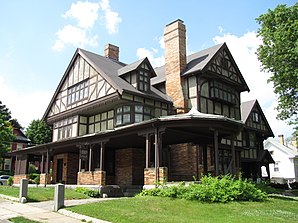
Norwood, Massachusetts
| Norwood | |
|---|---|
 |
|
| Location in Massachusetts | |
| Basic data | |
| Foundation : | 1872 |
| State : | United States |
| State : | Massachusetts |
| County : | Norfolk County |
| Coordinates : | 42 ° 12 ′ N , 71 ° 12 ′ W |
| Time zone : | Eastern ( UTC − 5 / −4 ) |
| Residents : | 28,602 (as of 2010) |
| Population density : | 1,055.4 inhabitants per km 2 |
| Area : | 27.3 km 2 (approx. 11 mi 2 ) of which 27.1 km 2 (approx. 10 mi 2 ) are land |
| Height : | 45 m |
| Postal code : | 02062 |
| Area code : | +1 339, 781 |
| FIPS : | 25-50250 |
| GNIS ID : | 0619460 |
| Website : | www.norwoodma.gov |
 |
|
Norwood is a small town ( Town ) in Norfolk County in the US state of Massachusetts in the United States with nearly 30,000 residents.
The southwestern suburb of Boston is accessible by the Massachusetts Route 1A , Interstate 95 , US Highway 1 , Massachusetts Route 128 as well as the Dedham – Willimantic railway and Norwood Memorial Airport ( IATA : OWD).
The location on the Neponset River and the former Boston Post Road was the location for the 2012 film Ted and is the home of the loss prevention center of the insurance company FM Global .
Personalities
- Frank G. Allen (1874–1950), politician
- Kenneth Amis (* 1970), tuba player
- Christopher Bird (1928-1996), botanist
- Fred Holland Day (1864-1933), photographer
- Paul Francis Duffy (1932-2011), Bishop
- Richie Hebner (born 1947), baseball player
- William R. Keating (born 1952), politician
- Frank Kilroy (1921-2007), football player
Web links
Commons : Norwood, Massachusetts - Collection of pictures, videos, and audio files
Individual evidence
- ↑ Town of Norwood in the Geographic Names Information System of the United States Geological Survey , accessed April 6, 2014
