Erving (Massachusetts)
| Erving | ||
|---|---|---|
 |
||
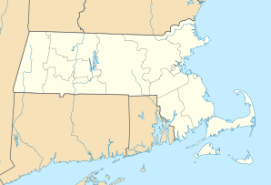
| Location in Massachusetts | ||
|
|
||
| Basic data | ||
| Foundation : | 1801 | |
| State : | United States | |
| State : | Massachusetts | |
| County : | Franklin County | |
| Coordinates : | 42 ° 37 ′ N , 72 ° 26 ′ W | |
| Time zone : | Eastern ( UTC − 5 / −4 ) | |
| Residents : | 1,800 (as of 2010) | |
| Population density : | 50.3 inhabitants per km 2 | |
| Area : | 37.3 km 2 (approx. 14 mi 2 ) of which 35.8 km 2 (approx. 14 mi 2 ) is land |
|
| Height : | 145 m | |
| Postal code : | 01344 | |
| Area code : | +1 413 | |
| FIPS : | 25-21780 | |
| GNIS ID : | 0618163 | |
| Website : | www.erving-ma.org | |
Erving is a town in Franklin County , Massachusetts , of 1,800 residents according to the 2010 census.
geography
The city is on the Mohawk Trail or Massachusetts Route 2 . The indigenous peoples of the Pocumtuc tribe were largely either exterminated or sold into slavery , particularly during the time of the King Philip's War . The city was founded in 1801 and declared a city in 1838.
Individual evidence
- ^ Profile of General Population and Housing Characteristics: 2010 Demographic Profile Data (DP-1): Erving town, Franklin County, Massachusetts, US Census Bureau, factfinder2.census.gov
swell
Web links
- www.erving-ma.org Official website
- www.rootsweb.ancestry.com
