Connecticut River
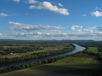
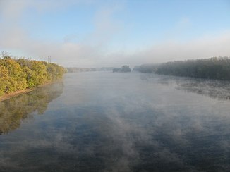
The Connecticut River is the longest river in New England in the United States .
It flows from the Connecticut Lakes in northern New Hampshire , south along the border between that state and Vermont , through western Massachusetts and central Connecticut , to finally flow into Long Island Sound at Old Saybrook . It has a length of 655 km and the catchment area covers 29,125 km². The average annual runoff is 556 m³ / s.
Thanks to numerous dams and locks, it is navigable for ships as far as Hartford . The river is subject to the tides until Windsor Locks , about 95 km above the mouth.
The Connecticut River drains part of the White Mountains in New Hampshire and the Green Mountains of Vermont to the south, as well as the eastern portion of the Berkshires in Massachusetts. In western Massachusetts, the Connecticut River flows through the broad Pioneer Valley . On the Connecticut River are the cities of Northampton , Springfield and Hartford , among others .
The river carries a large amount of silt , especially when the snowmelts in spring. This carried material created a sandbar near the confluence with Long Island Sound, which historically has been a significant barrier to shipping. Mainly for this reason, the Connecticut River is one of the few major rivers in New England that has not developed a major port city near its mouth. The river's estuary and its tidal flats form one of the 1759 wetlands of international importance protected by the Ramsar Convention .
The name of the river is a French corruption of the Algonquin word quinetucket and means long tidal river .
history
The first European to see the river was the Dutch explorer Adriaen Block in 1614 . As a result of this exploration, the Dutch named the river Fresh River . In 1623 they built a fortified trading post, Fort Huys de Goede Hoop , which later became Hartford , Connecticut. It was the northeastern part of the Nieuw Nederland colony .
The first English colonist whose presence at the river is recorded was Edward Winslow of Plymouth Colony in 1632 . In 1633 the English established a trading post on what is now Windsor . As the number of English colonists increased, the Dutch abandoned their business in 1654. The fort at Number 4 , now Charlestown , New Hampshire, was the northernmost English settlement on the river until the end of the French and Indian Wars in 1763. The Treaty of Paris (1783) , which ended the American Revolutionary War in 1783 , established the new border between New Hampshire and what became the province of Canada . Because the definition of the boundary, which included Connecticut's most northwestern headwaters, applies to several waterways, a boundary dispute led to the brief existence of the Indian Stream Republic , which existed from 1832 to 1835.
Initially, the wide, fertile valley attracted agricultural settlers, but the amount of water and the gradient of the river contributed to the rise of the manufacturing industry in the valley. The largest single drop with a height difference of 18 m is at Holyoke . Windsor and Hartford in Connecticut, Springfield in Massachusetts, Lebanon in New Hampshire and Brattleboro in Vermont developed into other economic centers .
In 1829 the Enfield Falls Canal was built to bypass flats on the Connecticut River. The locks built for this gave the city of Windsor Locks , Connecticut, its name.
In the late 19th century, the river was used to raft felled logs from the north, particularly from the Nullhegan River basin in Essex County , Vermont. The big rafts every spring were stopped after 1915 because the owners of pleasure boats complained about the dangers for shipping.
In 1953, in response to severe flooding on the river, the Connecticut River Flood Control Compact was closed. The agreement was signed by Connecticut, Massachusetts, New Hampshire and Vermont. In 1997 the river was designated as the American Heritage River .
Tributaries
The major tributaries of the Connecticut River are, from mouth to source:
| No. | Surname | Bank side of the confluence |
Catchment area in km² |
location |
|---|---|---|---|---|
| 01 | Black Hall River | Left | CT | |
| 02 | Falls River | right | CT | |
| 03 | Eightmile River | Left | 156 | CT |
| 04 | Deep river | right | CT | |
| 05 | Salmon River | Left | 388 | CT |
| 06 | Mattabesset River | right | 269 | CT |
| 07 | Hockanum River | Left | 210 | CT |
| 08 | Park River | right | 200 | CT |
| 09 | Farmington River | right | 1580 | CT |
| 10 | Scantic River | Left | 292 | CT |
| 11 | Westfield River | right | 1339 | MA |
| 12 | Mill River (Springfield) | Left | MA | |
| 13 | Chicopee River | Left | 1870 | MA |
| 14th | Manhan River | right | 271 | MA |
| 15th | Mill River (Northampton) | right | MA | |
| 16 | Fort River | Left | MA | |
| 17th | Mill River (Hatfield) | right | MA | |
| 18th | Mill River (Amherst) | Left | MA | |
| 19th | Sawmill River | Left | MA | |
| 20th | Deerfield River | right | 1702 | MA |
| 21st | Fall River | right | 92 | MA |
| 22nd | Millers River | Left | 1000 | MA |
| 23 | Ashuelot River | Left | 1101 | NH |
| 24 | West River | right | 1083 | VT |
| 25th | Partridge Brook | Left | NH | |
| 26th | Cold River | Left | 261 | NH |
| 27 | Saxtons River | right | 200 | VT |
| 28 | Williams River | right | 300 | VT |
| 29 | Black River | right | 517 | VT |
| 30th | Little Sugar River | Left | 79 | NH |
| 31 | Sugar River | Left | 704 | NH |
| 32 | Blow-me-down Brook | Left | NH | |
| 33 | Ottauquechee River | right | 571 | VT |
| 34 | Mascoma River | Left | 499 | NH |
| 35 | White River | right | 1818 | VT |
| 36 | Mink Brook | Left | NH | |
| 37 | Ompompanoosuc River | right | 348 | VT |
| 38 | Waits River | right | 369 | VT |
| 39 | Oliverian Brook | Left | NH | |
| 40 | Wells River | right | 253 | VT |
| 41 | Ammonoosuc River | Left | 1011 | NH |
| 42 | Stevens River | right | 125 | VT |
| 43 | Passumpsic River | right | 1298 | VT |
| 44 | Johns River | Left | 195 | NH |
| 45 | Israel River | Left | 346 | NH |
| 46 | Upper Ammonoosuc River | Left | 650 | NH |
| 47 | Paul Stream | right | 148 | VT |
| 48 | Nulhegan River | right | 387 | VT |
| 49 | Simms Stream | Left | NH | |
| 50 | Mohawk River | Left | 143 | NH |
| 51 | Hall's Stream | Left | 228 | NH |
| 52 | Indian Stream | Left | 182 | NH |
| 53 | Perry Stream | Left | 77 | NH |
Crossings
The Connecticut River is a major obstacle to traffic between the West and the East in New England. It is crossed by several major roads, including the Northeast Corridor of Amtrak , highways Interstate 95 ( Connecticut Turnpike ), Interstate 90 ( Massachusetts Turnpike ) and Interstate 89 . The Interstate 91 , the route in north-south direction largely follows the course of the river, crossed the river once in Connecticut and once again in Massachusetts.
Fish species in the Connecticut River
The Connecticut River is a habitat for several species of migratory fish , including Alosa sapidissima , American eel , Morone saxatilis, and sea lamprey . The United States Fish and Wildlife Service is working to bring the Atlantic salmon back home; this was no longer present in the river for more than 200 years. To enable these fish to migrate naturally upriver to their spawning grounds in spring, fish ladders and other facilities have been built.
Most of the town of Pittsburg , where the upper reaches of the river is located, is filled by the Connecticut Lakes , a chain of several deep, cool-water lakes that are home to lake trout and Atlantic salmon .
Brook trout , rainbow trout , brown trout , alosa , black bass , rock perch , carp , catfish and various other species are native to the river itself .
literature
- Edwin Monroe Bacon: The Connecticut River and the Valley of the Connecticut: Three Hundred and Fifty Miles from Mountain to Sea . GP Putnam's Sons, New York 1906, F12.C7 B2 in the LCC .
- Edmund Thomas Delany: The Connecticut River: New England's Historic Waterway . The Globe Pequot Press, 1983, ISBN 978-0-87106-980-1 .
- Walter R. Hard: The Connecticut (Rivers of America) . Rinehart & Company, Inc, New York, Toronto 1947, ISBN 0-932691-27-7 , F12.C7 H3 in the LCC .
- Randolph A. Roth, The Democratic Dilemma: Religion, Reform, and the Social Order in the Connecticut River Valley of Vermont, 1791-1850 . Cambridge University Press, Cambridge, Mass. 2003, ISBN 978-0-521-31773-3 .
Web links
Individual evidence
- ↑ Dorothy A. DEBISSCHOP: The Canal at Windsor Locks ( English ) Connecticut Heritage. Archived from the original on September 30, 2007. Info: The archive link was inserted automatically and has not yet been checked. Please check the original and archive link according to the instructions and then remove this notice. Retrieved June 9, 2011.
- ^ Wheeler, Scott: The History of Logging in Vermont's Northeast Kingdom ( English ). The Kingdom Historical, September 2002.
- ^ Connecticut River Flood Control Compact. (PDF; 34 kB) Connecticut River Valley Flood Control Commission, September 8, 1953, accessed May 22, 2020 .
- ^ Smith College


