Deerfield River
The Deerfield River is a right tributary of the Connecticut River in the US states of Vermont and Massachusetts .
River course
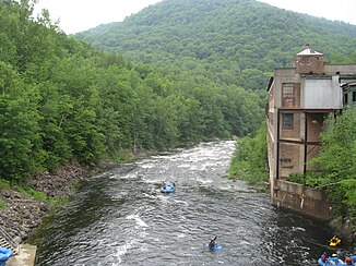
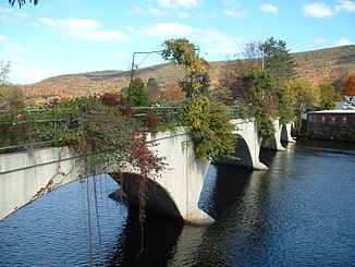
The Deerfield River rises in the Green Mountains in southern Vermont, northwest of the Somerset Reservoir . From there it flows south. It takes in the Glastenbury River from the right and the East Branch from the left. It then flows through the Searsburg Reservoir and Harriman Reservoir . The North Branch also flows into the Harriman Reservoir. In Readsboro , the West Branch meets the river on the right. The Deerfield River then flows through the Sherman Reservoir , into which the South Branch flows, and reaches Massachusetts. Then there is the town of Monroe and shortly thereafter the lower basin of the Jack Cockwell pumped storage power plant on the river. Now the river turns to the east. Charlemont and Shelburne Falls are on the lower Deerfield River. The Mohawk Trail ( Massachusetts Route 2 ) runs along the river on this route. The Deerfield River takes the Green River on the left shortly before its mouth and meets the Connecticut River on the southern edge of Greenfield . The Deerfield River has a length of 122 km.
Hydropower plants
There are several hydropower plants on the Deerfield River. Electricity has been generated on the river since the beginning of the 20th century. The Jack Cockwell pumped storage power plant was formerly known as Bear Swamp .
The hydropower plants in the downstream direction:
| Surname | Power in MW |
Number of turbines |
location | operator |
|---|---|---|---|---|
| Searsburg | 4.1 | 1 | ( ⊙ ) | TransCanada Hydro Northeast |
| Harriman | 33.6 | 3 | ( ⊙ ) | TransCanada Hydro Northeast |
| Sherman | 7.2 | 1 | ( ⊙ ) | TransCanada Hydro Northeast |
| Deerfield 5 | 17.5 | 1 | ( ⊙ ) | TransCanada Hydro Northeast |
| Jack Cockwell | 600 | 2 | ( ⊙ ) | Brookfield Renewable |
| Fife Brook | 11.2 | 1 | ( ⊙ ) | Brookfield Renewable |
| Deerfield 4 | 4.8 | 3 | ( ⊙ ) | TransCanada Hydro Northeast |
| Deerfield 3 | 4.8 | 3 | ( ⊙ ) | TransCanada Hydro Northeast |
| Gardner's Falls | 2.2 | 4th | ( ⊙ ) | North American Energy Massachusetts |
| Deerfield 2 | 4.8 | 3 | ( ⊙ ) | TransCanada Hydro Northeast |
![]() Map with all coordinates: OSM | WikiMap
Map with all coordinates: OSM | WikiMap
Others
On the Deerfield River on the banks of the Sherman Reservoir, the Yankee Rowe nuclear power plant was located , which was in operation between 1960 and 1992.

