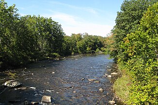
Westfield River
|
Westfield River East Branch Westfield River, Agawam River |
||
|
Westfield River at Huntington MA |
||
| Data | ||
| Water code | US : 619263 | |
| location | Massachusetts (USA) | |
| River system | Connecticut River | |
| Drain over | Connecticut River → Atlantic Ocean | |
| Confluence of |
Center Brook and Drowned Land Brook 42 ° 34 ′ 9 ″ N , 73 ° 1 ′ 54 ″ W. |
|
| Source height | 528 m | |
| muzzle |
Connecticut River Coordinates: 42 ° 5 '3 " N , 72 ° 35' 8" W 42 ° 5 '3 " N , 72 ° 35' 8" W. |
|
| Mouth height | 15 m | |
| Height difference | 513 m | |
| Bottom slope | 4.1 ‰ | |
| length | 126 km | |
| Catchment area | 1339 km² | |
| Discharge at the Westfield gauge ( ⊙ ) A Eo : 1272 km² Location: 13 km above the estuary |
MQ 1915/2012 Mq 1915/2012 |
27 m³ / s 21.2 l / (s km²) |
| Right tributaries | Middle Branch Westfield River , West Branch Westfield River , Little River | |
| Reservoirs flowed through | Knightville Reservoir | |
| Medium-sized cities | Agawam , West Springfield | |
| Small towns | Westfield | |
| Communities | Cummington , Huntington , Russell | |
| National Wild and Scenic River | ||
|
Westfield River catchment area |
||
The Westfield River is a right tributary of the Connecticut River in the US state of Massachusetts .
The river system of the Westfield River has three headwaters, whereby the largest and longest, the East Branch , according to GNIS, is assigned to the actual river. This arises in the Berkshire Mountains at the confluence of Center Brook and Drowned Land Brook . It initially flows in a predominantly east-southeast direction past Cummington . The Route 9 here runs along the river. Later the river turns south and flows through Chesterfield Gorge . Further downstream is the Knightville Dam . Shortly thereafter, the Middle Branch Westfield River and at Huntington the West Branch Westfield River , both on the right side, flow into the Westfield River. Now the river turns towards east-southeast. It passes through Russell and reaches Agawam and West Springfield . Finally, the Westfield River joins the Connecticut River north of the South End Bridge . The Westfield River is one of the Connecticut River's largest tributaries. It has a length of 126 km and drains an area of 1339 km².
leisure
Sections of the three headwaters of the Westfield River have been designated as National Wild and Scenic River since November 2, 1993 and October 29, 2004, respectively.

