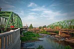
Westfield, Massachusetts
| Westfield | |
|---|---|
 |
|
| Location in Massachusetts | |
| Basic data | |
| Foundation : | November 2, 1920 |
| State : | United States |
| State : | Massachusetts |
| County : | Hampden County |
| Coordinates : | 42 ° 8 ′ N , 72 ° 45 ′ W |
| Time zone : | Eastern ( UTC − 5 / −4 ) |
| Residents : | 41,094 (as of 2010) |
| Population density : | 340.7 inhabitants per km 2 |
| Area : | 122.6 km 2 (approx. 47 mi 2 ) of which 120.6 km 2 (approx. 47 mi 2 ) is land |
| Height : | 45 m |
| Postcodes : | 01085, 01086 |
| Area code : | +1 413 |
| FIPS : | 25-76030 |
| GNIS ID : | 0608962 |
| Website : | www.cityofwestfield.org |
| Mayor : | Daniel Knapik |
 |
|
Westfield is a city ( City ) in Hampden County , Massachusetts , USA with more than 40,000 inhabitants.
history
Westfield was the scene of King Philip's War , a rebellion and the like , from 1675 to 1676 . a. Pocumtuc, who previously lived here in southern New England . The New England hurricane raged here in 1938 .
traffic
The place about 10 kilometers west of Springfield is accessible by the Massachusetts Turnpike , Barnes Airport ( IATA : BAF) and the Worcester – Albany , New Haven – Shelburne Junction and Westfield – Holyoke railway lines.
landscape
The Stanley Park of Westfield Botanical Gardens and partly Robinson State Park are located in the municipal area through which the Westfield River flows.
economy
The gunsmith Savage Arms is based here, as is the Zing Studios music studio , where the local metal band Killswitch Engage had their third album recorded.
Personalities
- Edward Taylor (1641-1729), poet
- William Shepard (1737-1817), officer
- Moses Hayden (1786-1830), politician
- Gorham Parks (1794–1877), politician
- Mark Trafton (1810-1901), politician
- James Wakefield (1825-1910), politician
- Ferdinand Vandeveer Hayden (1829-1887), geologist
- Frederick H. Gillett (1851-1935), politician
- George B. Cortelyou (1862-1940), Minister
- Joseph B. Ely (1881–1956), Governor
- Anne Pitoniak (1922–2007), actress
- Frederic Rzewski (* 1938), pianist
- Kacey Bellamy (* 1987), ice hockey player
Web links
Individual evidence
- ^ Westfield in the United States Geological Survey's Geographic Names Information System , accessed April 7, 2014
