Lebanon (New Hampshire)
| Lebanon | ||
|---|---|---|
 Lebanon city center |
||
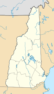
| Location in New Hampshire | ||
|
|
||
| Basic data | ||
| Foundation : | 1761 | |
| State : | United States | |
| State : | New Hampshire | |
| County : | Grafton County | |
| Coordinates : | 43 ° 37 ′ N , 72 ° 15 ′ W | |
| Time zone : | Eastern ( UTC − 5 / −4 ) | |
| Residents : | 13,151 (as of 2010) | |
| Population density : | 126 inhabitants per km 2 | |
| Area : | 107.0 km 2 (approx. 41 mi 2 ) of which 104.4 km 2 (approx. 40 mi 2 ) is land |
|
| Height : | 177 m | |
| Postcodes : | 03756, 03766 | |
| Area code : | +1 603 | |
| FIPS : | 33-41300 | |
| GNIS ID : | 0873643 | |
| Website : | www.LebNH.net | |
| Mayor : | Timothy J. McNamara | |
Lebanon is a city in Grafton County in the US state of New Hampshire . Lebanon lies on a plateau of the Green Mountains , the so-called Upper Valley .
history
The city was founded on July 4, 1761 by Governor Benning Wentworth . The first settlement area was on the Connecticut River , which is now referred to as West Lebanon.
Demographics
The result of the 2000 census was as follows.
| White | Afro- American |
Hispanic | Indigenous people | Asian | Pacific | other | 2+ |
|---|---|---|---|---|---|---|---|
| 94.38% | 0.83% | 1.64% | 0.43% | 2.67% | 0.03% | 0.41% | 1.26% |
| households | with children | Married | Single parent |
without family | Single | Single 65+ | |
| 5500 | 28.3% | 45.6% | 9.4% | 42.2% | 33.7% | 10.5% |
sons and daughters of the town
- Nicholas Alexander (* 1988), ski jumper
- Aaron Baddeley (* 1981), Australian professional golfer
- Thomas M. Debevoise (1929-1995), lawyer and politician, the Vermont Attorney General was
- Rebekah Driscoll (* 1980), composer
- Elisha P. Jewett (1801-1894), politician, Vermont State Treasurer was
- Phineas Parkhurst Quimby (1802–1866), alternative practitioner who represented the new spirit movement in the course of the revival movement in the southern United States
- Phineas Gage (1823-1860), survived an iron bar pierced through his head
Web links
- Historical Society (English)
