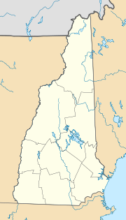
Haverhill, New Hampshire
| Haverhill | ||
|---|---|---|
 Town Hall Haverhill |
||
| Location in New Hampshire | ||
|
|
||
| Basic data | ||
| Foundation : | 1763 | |
| State : | United States | |
| State : | New Hampshire | |
| County : | Grafton County | |
| Coordinates : | 44 ° 5 ′ N , 72 ° 0 ′ W | |
| Time zone : | Eastern ( UTC − 5 / −4 ) | |
| Residents : | 4,697 (as of 2010) | |
| Population density : | 35.6 inhabitants per km 2 | |
| Area : | 135.0 km 2 (approx. 52 mi 2 ) of which 132.1 km 2 (approx. 51 mi 2 ) are land |
|
| Height : | 215 m | |
| Postal code : | 03765 | |
| Area code : | +1 603 | |
| FIPS : | 33-34820 | |
| GNIS ID : | 0873621 | |
| Website : | www.Haverhill-NH.com | |
Haverhill is a municipality ( town ) in the US state of New Hampshire and the administrative seat of Grafton County with 4697 inhabitants.
geography
Haverhill has an area of 135.0 km², of which 132.1 km² is land and 2.9 km² (2.15%) is water. The place is bounded to the west by the Connecticut River and drained by the Ammonoosuc River and the Oiverian and Clark streams, which are in the catchment area of Connecticut.
Community structure
Haverhill City includes Haverhill, Woodsville, Pike, North Haverhill, and the Mountain Lakes District.
history
The place was settled by citizens of the place of the same name in Massachusetts and was initially called Lower Coos . In 1763 the settlement became a town . In 1773 Haverhill became the administrative seat of Grafton County .
sons and daughters of the town
- John A. Page (1814-1891), politician and Vermont State Treasurer
