Alexandria, New Hampshire
| Alexandria | ||
|---|---|---|
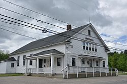
 Town Hall, Alexandria |
||
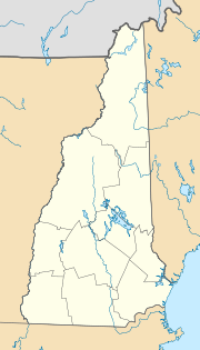
| Location in New Hampshire | ||
|
|
||
| Basic data | ||
| Foundation : | 1753 | |
| State : | United States | |
| State : | New Hampshire | |
| County : | Grafton County | |
| Coordinates : | 43 ° 37 ′ N , 71 ° 51 ′ W | |
| Time zone : | Eastern ( UTC − 5 / −4 ) | |
| Residents : | 1,611 (as of 2017) | |
| Population density : | 14.5 inhabitants per km 2 | |
| Area : | 111.7 km 2 (approx. 43 mi 2 ) of which 111.2 km 2 (approx. 43 mi 2 ) is land |
|
| Height : | 440 m | |
| Postal code : | 03222 | |
| Area code : | +1 603 | |
| FIPS : | 33-00580 | |
| GNIS ID : | 873527 | |
| Website : | www.AlexandriaNH.com | |
Alexandria is a town on Newfound Lake in Grafton County in New Hampshire in the United States of America . The settlement permit, with which the area of Alexandria was released for official settlement, dates to 1753. The number of inhabitants was 1611 in 2017. The only other district is South Alexandria on the Smith River .
history
Alexandria has had the status of a registered municipality since 1782. The name was probably chosen based on Alexandria in Virginia . The first meeting of governors of various states and provinces in North America took place there in 1755. Eight years after its registration, Alexandria had 298 residents.
population
The population is almost 98% Caucasian. The remaining two percent are of African, Asian or Indian origin or indicate more than one origin. The gender distribution is balanced, 74.3% were between 5 and 65 years old in 2000.
Administration and municipal institutions
The municipal administration is headed by a municipal council, consisting of three councilors and a manager. The administration includes the tax office with an enforcement officer and deputy, the road construction office, volunteer fire brigade and police. The latter includes an animal welfare officer. The police chief works on a part-time basis and also fulfills the role of an emergency coordinator. The community also employs treasurers, health officers, a forest fire watchdog and two moderators. In addition to the planning commission, there are committees for the community budget, recycling and nature conservation. Alexandria has a recycling station, where paper and metals are sorted, a library and a church. Medical emergency service takes place on a voluntary basis, comparable to the volunteer fire brigade . The closest hospital is the Speare Memorial in Plymouth, 21 miles away . There is no public water supply or sanitation. Water comes from private wells. The wastewater is also collected in private tanks.
Economy and Transport
There are four commercial operations in the local area with a total of fifteen employees. The largest company is a company producing floating oil and similar barriers. Alexandria has no rail or direct motorway access. The NH 104 state road, also known as the Ragged Mountain Highway, runs through South Alexandria and crosses Interstate I-93 nine miles away. In nearby Bristol there is a commercial airport , the Newfound Valley Airport . The nearest airport with scheduled flights is in Lebanon , 64 kilometers away , and the nearest intercontinental airport is Logan International Airport in Boston, 174 kilometers away.
tourism
In the north of Alexandria is the Newfound Lake, which is partly on municipal territory, as well as the Mount Cardigan State Park in the west. In the latter is a lodge of the Appalachian Mountain Club, one of the oldest leisure associations in the USA. In terms of tourist facilities, Alexandria has beaches and a marina on Newfound Lake, snowmobiling and cross-country skiing trails, state park trails, and campsites. There are opportunities for hunting and fishing.
people
- Luther C. Ladd, first fallen soldier in the American Civil War
