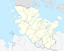
Geographical center of Schleswig-Holstein
Coordinates: 54 ° 11 ′ 8 ″ N , 9 ° 49 ′ 20 ″ E
A point in the Thienbüttel district of the city of Nortorf in the Rendsburg-Eckernförde district was determined as the geographical center of Schleswig-Holstein and marked in 2001. Its position is 54 degrees, 11 minutes and 7.9353 seconds North, 9 degrees, 49 minutes and 19.5452 seconds East.
The point was calculated by the land surveying office on the initiative of the NDR . Schleswig-Holstein was divided into more than 30,000 "planning triangles", which were evaluated by computer. The center point is on the road between Nortorf and Brammer , about one kilometer behind the Nortorf town sign in the direction of Brammer on the right-hand side of the road. On May 18, 2001, Nortorf's mayor, Hans-Helmut Köppe, unveiled the center, which is now marked with a millstone labeled “The center of Schleswig-Holstein”. Next to the millstone are two pillars bearing the coat of arms of the city of Nortorf and the state of Schleswig-Holstein, as well as a flagpole and benches.
Web links
- Geographical center on the website of the city of Nortorf, accessed June 30, 2013

