
Araripe Geopark
|
Araripe Geopark
|
||
 Chapada do Araripe |
||
| location | Ceará , Brazil | |
| surface | 3441 km² | |
| Geographical location | 7 ° 23 ′ S , 39 ° 31 ′ W | |
|
||
| particularities |
|
|


The Geopark Araripe , also Geoparque Araripe , is a Geopark established in 2006 in the Brazilian state of Ceará and the first of its kind in Latin America to be recognized as a UNESCO Global Geopark .
location
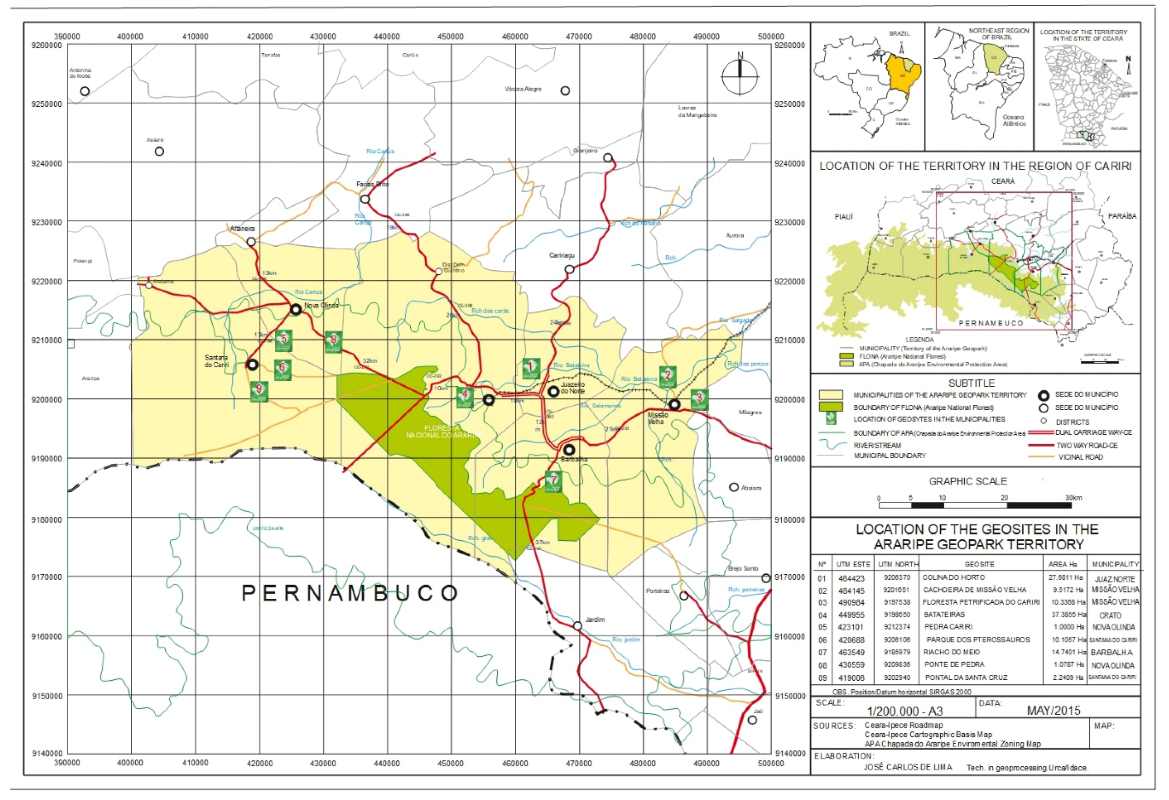
It lies within the catchment area of six cities: Barbalha , Crato , Juazeiro do Norte , Missão Velha , Nova Olinda and Santana do Cariri and covers 3,441 km². The park displays a rich inventory of biological, geological and paleological natural resources. It is characterized by the Araripe Basin, the Araripe Mountains and the Santana Formation . In the south it is bounded by the state of Pernambuco . A railway line leads to Crato.
Geological sites
Mainly nine locations and formations are accessible to visitors and are subject to current research: Colina do Horto near Juazeiro do Norte, Cachoeira de Missão Velha near Missão Velha, Floresta Petrificada do Cariri near Missão Velha, Batateira near Crato, Pedra Cariri near Nova Olinda, Parque dos Pterossauros near Santana do Cariri, Riacho do Meio near Barbalha, Ponte de Pedra near Nova Olinda and Pontal de Santa Cruz near Santana do Cariri.
Geotourism
Geotourism is being promoted in the structurally weak region .
literature
- Marcelo Leite: Brazil: paisagens naturais. Espaço, sociedade e biodiversidade nos grandes biomas brasileiros . Editora Ática, São Paulo 2003, ISBN 85-08-10863-X .
- Araripe Geopark: histórias da terra, do meio ambiente e da cultura . Universidade Regional do Cariri, Fortaleza 2012. ( Online , PDF, 12 MB).
Web links
- Geopark Araripe on UNESCO's Global Geoparks website.
- Official website
- map
- Relief map
Individual evidence
- ↑ Chapada do Araripe vira parque geológico. In: Folha de S. Paulo . September 25, 2006, Retrieved June 6, 2018 (Brazilian Portuguese).
- ↑ François Betard, Jean-Pierre Peulvast, Alexsandra Magalhães de Oliveira, Maria de Lourdes Carvalho Neta, Francisco Idalécio de Freitas: Araripe Basin: A Major geodiversity hotspot in Brazil . In: Geoheritage . Springer, May 13, 2017, ISSN 1867-2477 , p. 1–16 , doi : 10.1007 / s12371-017-0232-5 (English).
- ^ Willi Czajka : The Serra do Araripe. A table mountain in northeast Brazil . In: The Earth . tape 88 , 1957, ISSN 0013-9998 , pp. 320-333 ( digizeitschriften.de [accessed on June 6, 2018]).
- ↑ Eduardo S. Guimarães et al. a .: Matrix of Priorities for the Management of Visitation Impacts on the Geosites of Araripe UNESCO Global Geopark (NE Brazil) . In: Geosciences . tape 8 , no. 6 , June 1, 2018, p. 199–220 , doi : 10.3390 / geosciences8060199 (English, mdpi.com [accessed June 6, 2018]).