Gertingers
Coordinates: 50 ° 57 ′ 32 ″ N , 9 ° 44 ′ 24 ″ E
Gert Ingers was a first documentary attested in 1267, on the eastern edge of today's district of Lüdersdorf , a district of Bebra in osthessischen Hersfeld-Rotenburg .
location
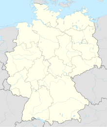
The desert of Gertiger is 1.7 km to the west above the center of Lüdersdorf in the Lüdersdorfer Forest. The former church is located on the Kirchrain on a slightly elevated ridge to the west.
Web links
- "Gertingers, District of Hersfeld-Rotenburg". Historical local dictionary for Hessen. In: Landesgeschichtliches Informationssystem Hessen (LAGIS).
- History on the local website Lüdersdorf
Individual evidence
- ↑ "Gertingers, Hersfeld-Rotenburg district". Historical local dictionary for Hessen. (As of November 4, 2010). In: Landesgeschichtliches Informationssystem Hessen (LAGIS).
