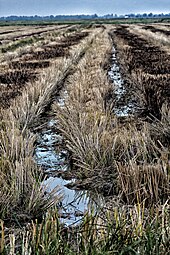
Gharb plain
The Gharb Plain ( Arabic غرب= "West"; also transcribed as Rharb plain ) is an agriculturally intensively used region in north-west Morocco .
geography
location
The Gharb plain, consisting essentially of parts of the three provinces Kénitra , Sidi Slimane and Sidi Kacem , extends at a height of approx. 10 to 100 m from the hilly landscape of the western foothills of the Rif Mountains to the rather flat coastal strip on the Atlantic Ocean . The area of the Gharb is given as 616,000 hectares, of which 388,000 hectares can be used for agriculture.
Cities
The largest and most important cities in the region are Kénitra (approx. 435,000 inhabitants), Sidi Slimane (approx. 95,000 inhabitants), Sidi Kacem (approx. 75,000 inhabitants), Souk El Arbaa (approx. 70,000 inhabitants) and Sidi Yahya El Gharb (approx. 40,000 inhabitants).
Rivers
The most important river of the Gharb is the often winding Oued Sebou ; its largest tributary, the Oued Ouerrha dammed in the al-Wahda reservoir, roughly forms the eastern border. There are also smaller brooks that overflow their banks after heavy or prolonged rainfall and flood places and fields for several days. Water for field irrigation is taken from the rivers and streams. There is no reservoir in the mostly flat landscape of the Gharb plain.
climate
For Moroccan conditions, the climate of the Gharb plain, which is largely influenced by the Atlantic, is more moderate and rainy (approx. 500 mm / year).
population
The names of several Berber tribes that used to settle here are known from the region ( Beni Hssen, Safiane, Beni Malek, Khlout, Chrarda and Sahel ), whose former political and cultural significance is no longer relevant today. In the second half of the 20th century, many Berber families immigrated from the mountain regions of Morocco, but Moroccan Arabic is spoken predominantly .
economy
Agriculture, which has been practiced in the Gharb for over 2000 years, is still the central economic factor today. The Gharb was part of the "granary" Africa , which was so important for the grain supply of the Roman Empire - Volubilis , the second most important city in the province of Mauretania Tingitana was only a few kilometers south of the Gharb. Numerous French ( colons ) settled here during the Protectorate (1912–1956) and the Gharb plain is still one of the most important agricultural areas in Morocco. On almost 4000 km² of usable area, mainly wheat, beets, rice, sunflowers, maize and sugar cane are grown on predominantly rich soil; The latter was a popular import item in Europe in the Middle Ages. Cattle are also bred in fattening farms; Increasing milk and meat production is a declared goal of those responsible.
See also
- Doukkala plane
- Souss plain
- Tadla plain
literature
- Mohamed Bentazar: L'Agriculture Dans la Region Gharb du Maroc. L'Agriculture entre 1984 et aujourd'hui. Edilivre-Aparis, Saint-Denis 2014, ISBN 978-2332863706
Web links
- Northern Morocco and Gharb - satellite image, photos, maps + information (French)
- Gharb - short information
- Gharb - beekeeping (French)

