Gibbon Bay
| Gibbon Bay | ||
|---|---|---|
|
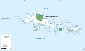
Map of Coronation Island (center) with Gibbon Bay |
||
| Waters | Lewthwaite Strait | |
| Land mass | Coronation Island , South Orkney Islands | |
| Geographical location | 60 ° 39 ′ 10 ″ S , 45 ° 12 ′ 24 ″ W | |
|
|
||
| length | 1.5 km | |
The Gibbon Bay is a 1.5 km long bay on the east coast of Coronation Iceland in Archipelago of the South Orkney Islands . Your entrance is between the headlands of Rayner Point and The Turret .
The British whaling captain George Powell and his American counterpart Nathaniel Palmer sighted the bay together in December 1821. The Norwegian whaling captain Petter Sørlle made a position determination in 1912. Scientists from the British Discovery Investigations specified this in 1933 and named the bay after Geoffrey McKay Gibbon (1896–1983), the ship's doctor for RRS Discovery II .
Web links
- Gibbon Bay in the Geographic Names Information System of the United States Geological Survey (English)
- Gibbon Bay on geographic.org (English)

