Glücksthal
The former village of Glücksthal is now a desert on the corridors of Neuhaus am Rennweg in Thuringia . The place is south of the Rennsteig , about three kilometers southwest of Neuhaus.
history
In 1736, Karl Friedrich Anton I , Duke of Saxony-Meiningen , awarded the glass masters Stephan Greiner and Johann Greiner from Lauscha the concession to build a glassworks southwest of Hedgehog in a wooded area infested with bark beetles . Since the late Middle Ages, the place in a small valley had often been used by blacksmiths and pitch burners.
After the construction of a glassworks and residential and utility houses, the production of particularly high-quality table and wine glasses began on August 17, 1738. Up to 24 workers were employed and up to 31 people lived in the glassworks settlement, which in its final years consisted of 3 residential and 3 industrial buildings. In the glassworks, Georg Heinrich Macheleid carried out firing tests with various clays for porcelain production. In 1757 he made the decisive discoveries. He subsequently received the concession to manufacture his porcelain from the Principality of Schwarzburg-Rudolstadt and founded the porcelain factory in Volkstedt .
From 1768 wood became scarcer. Growing competition from Prussia and Russia, the general decline of the glass industry and disagreements in the family finally led to the cessation of production in 1838. In 1829 the Greiner family built a new glassworks in neighboring Bernhardsthal, which melted glass until 1861. In 1856, Glücksthal was sold by Carl Alfred Greiner to the state of Saxony-Meiningen, which had the houses demolished in 1860. The Hüttenmeisterhaus remained in the possession of the Greiner family. It was dismantled and rebuilt in the buck and the pond .
Desolation
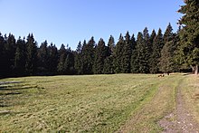
Traces of the former glassworks settlement are a striking clearing, a pond, an existing cellar vault built using drywall construction and the preserved forest cemetery. The penultimate hut owner Traugott Christian Greiner, grandson of Johann Greiner, was buried next to his relatives in 1845. The Heimatverein Neuhaus am Rennweg has redesigned the area as a hiking destination.
literature
- Thomas Schwämmlein: District of Sonneberg. (Monument topography of the Federal Republic of Germany. Cultural monuments in Thuringia 1.) E. Reinhold Verlag, Altenburg 2005, p. 299.
- Heimatverein Neuhaus am Rennweg eV: Two information boards with pictures and text to explain the desertification
Individual evidence
- ^ Prof. G. Brückner: Landeskunde des Herzogthums Meinigen , Volume 2: The topography of the country , Verlag Brückner and Renner, Meinigen 1853, p. 476
Web links
Coordinates: 50 ° 29 ′ 43 ″ N , 11 ° 6 ′ 44 ″ E


