
Bock and pond
|
Bock and pond
City of Neuhaus am Rennweg
Coordinates: 50 ° 31 ′ 28 ″ N , 11 ° 13 ′ 22 ″ E
|
|
|---|---|
| Height : | 620 m above sea level NN |
| Incorporation : | July 1, 1950 |
| Incorporated into: | Light |
| Postal code : | 98724 |
| Area code : | 036701 |
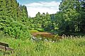
 Bock and pond looking towards Wallendorf
|
|
Bock und Teich is a village in the Lichte district of the city of Neuhaus am Rennweg in the Sonneberg district in Thuringia .
location
The mountain slopes of the Piesau and Lichte valleys drop off steeply. This landscape, through which the river squeezes, belongs to the lower reaches of the light . The parts of the Bock and Teich district are located there. The tributary of the Piesau into the Lichte begins at the east end of Lichte. In the middle of the village of Lichte, it flows north to Geiersthal .
history
Bock was first mentioned as a forge in Wallendorf in 1481 and Teich in 1609.
Territorial Affiliation
The region around Schmiedefeld , which is part of the southern dominion of the Counts of Orlamünde , was taken over by the Wettins from 1426 , who set up the Graefenthal office at Wespenstein Castle . From 1826 to 1920 Schmiedefeld belonged to Sachsen-Meiningen , from 1868 to the district of Saalfeld . The state of Thuringia was founded in 1920 and then subdivided into districts, whereby the place came to the district of Saalfeld , this existed until 1952. With the formation of the GDR districts and districts in the same year, the area came to the district of Neuhaus in the Suhl district .
On January 1, 2019, Bock and Teich came to the city of Neuhaus am Rennweg as part of the incorporation of Lichte and thus moved from the Saalfeld-Rudolstadt district to the Sonneberg district.
Local history

The settlement of the 7 km long Piesau valley was promoted by early modern mining. Copper ore was mined, melted and processed into semi-finished products in hammer mills in the valley. Relics of this mining activity, which at times extended to the entire Piesau Valley, can still be found in the corridor of the village. In the middle of the 19th century, the historian Georg Brückner describes the situation around Graefenthal and Wallendorf in the second volume of his "Landeskunde des Herzogthums Meinigen".
- The upper trestle, the lower trestle and the pond
- These three places, which are basically the Piesau between the confluence of the Kolmbach and Wallendorf and close to each other, have formed a political municipality since 1844. Formerly parish, trained and buried in Schmiedefeld, since 1734 in Wallendorf. Until recently they were under the rule of Wallendorf (jurisdiction, ..., merrymaking and mill compulsion). The entire community has 30 residential and three work houses, 30 families, 182 residents, 94 head of cattle (53 cattle, 25 goats, 10 pigs).
- The upper Bock (formerly also "Bockhammer") has (1849) 3 houses, 9 families, ... The smelting plant (Blaufeuer) that was located there in 1842 went down. A large heap here bears witness to the operation of an earlier copper (mine) works in the interior of the mountain adjoining here to the north. ... The entrances have been buried, and the considerable water art has also died. One differentiates (in the corridor) the large, small and upper Kupferthal.
- The lower bock and the pond, two groups of houses, contain (1849) 17 residential houses, a work house, 22 families, 128 souls and 78 head of cattle ...
- The lower goat (lies) just below the upper one; here a rod hammer with a furnace, a private property.
- Pond (formerly "Stauchenhammer", then "Wüster Teich"), single houses, ..., at the influence of the Kolmbach in the Piesau, on the Kleeberg ... Formerly above the pond there was a blue color mill and a farm. There are unused peat stores in the Kolmbach valley.
The Lichte (Thuringia) Ost station on the outskirts of Bock was put into operation on January 16, 1899 under the name Bock-Wallendorf as the new terminus of the Probstzella – Taubenbach railway . This station was also important for the increasing freight transport of the later district town of Neuhaus am Rennweg. With the completion of the Probstzella – Neuhaus am Rennweg railway line in 1913, from 1913 with continuation to Lauscha , the terminus station became a through station .
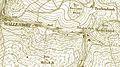
Location and extent of the districts of Bock and Teich around 1850

Felsenbühne-Kleeberg
Kulmbach

Town view from 1938
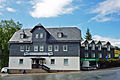
Hotel Kleeberg


_Die_Siedlung_Bock_und_Teich.jpg)

Web links
Individual evidence
- ^ Wolfgang Kahl : First mention of Thuringian towns and villages. A manual. 5th, improved and considerably enlarged edition. Rockstuhl, Bad Langensalza 2010, ISBN 978-3-86777-202-0 , pp. 36 and 282.
- ↑ Thuringian Law and Ordinance Gazette No. 14/2018 p. 795 ff. , Accessed on January 19, 2019
- ↑ a b c d e f Georg Brückner : Regional studies of the Duchy of Meiningen. Volume 2: The topography of the country. Brückner and Renner, Meiningen 1853, pp. 592–593 .
Lichte (consisting of Bock and Teich , Geiersthal , Oberlichte with Ascherbach , Waschdorf and Hügel as well as Wallendorf with Lamprecht ) | Limbach | Neuhaus am Rennweg with hedgehog and narrow beech | Neumannsgrund | Piesau | Scheibe-Alsbach with Alsbach and Scheibe | Siegmundsburg | Steinheid