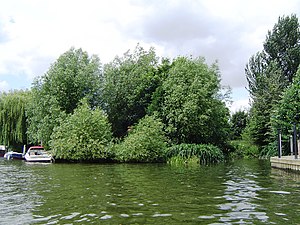
Grand Junction Isle
| Garrick's Ait | ||
|---|---|---|
|
Grand Junction Isle (looking upstream) |
||
| Waters | Thames | |
| Geographical location | 51 ° 24 ′ 36 ″ N , 0 ° 23 ′ 19 ″ W | |
|
|
||
| length | 35 m | |
| width | 15 m | |
The Grand Junction Isle is an island in the Thames above the Molesey Lock in Sunbury-on-Thames , Surrey , England .
geography
The island is diamond-shaped and at its longest point 35 m long and a maximum of 15 m wide. There are six small weekend houses with boat moorings on the island. A pedestrian bridge connects the island with the north bank of the river.
history
The island is named for the Grand Junction Waterworks Company , which was one of three companies that operated the Hampton Waterworks on the Hampton-Sunbury border. The company built a pumping station on the island that now powers Thames Water's treatment plants . The island was formerly called Purvis Ait . Now the island is owned by the Environment Agency .
See also
Individual evidence
- ^ Fred S. Thacker: The Thames Highway. Volume II: Locks and Weirs. 1920. (Reissued 1968 by David & Charles, ISBN 0-7153-4233-9 .) OCLC 55209571

