Gritzer See
| Gritzer See | ||
|---|---|---|

|
||
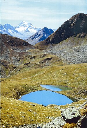
| Gritzer See with a view of Hochgall | ||
| Geographical location | East Tyrol ( Austria ) | |
| Drain | Froditzbach → Schwarzach | |
| Data | ||
| Coordinates | 46 ° 56 '36 " N , 12 ° 22' 57" E | |
|
|
||
| Altitude above sea level | 2504 m above sea level A. | |
| surface | 1.4 ha | |
| length | 185 m | |
| width | 95 m | |
| scope | 475 m | |
The Gritzer See is 2504 m above sea level. A. high mountain lake in the Lasörling group in East Tyrol . It is framed by Kastal ( 2776 m above sea level ), Hofspitze ( 2819 m above sea level ), Scheibe ( 2766 m above sea level ) and Gritzer Hörndl ( 2631 m above sea level ).
reachability
The Gritzer See can be easily reached via marked hiking trails. The ascent from the Speikbodenhütte (St. Veit) takes about two hours, the one from the Lasörlinghütte ( Virgen ) via the Virgentörl takes about one hour.
literature
- Walter Mair: Osttiroler Wanderbuch , pp. 351–353
Web links
Commons : Gritzer See - Collection of images, videos and audio files
