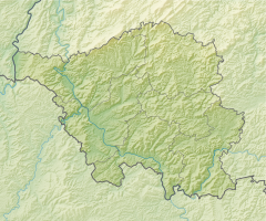
St. Ingbert mine
| St. Ingbert coal mine | |||
|---|---|---|---|
| General information about the mine | |||
| Richbachstollen mouth hole | |||
| other names | Richbachstollen visitor mine | ||
| Information about the mining company | |||
| Start of operation | (1842) | ||
| End of operation | 1957 | ||
| Successor use | Visitor mine | ||
| Funded raw materials | |||
| Degradation of | Hard coal | ||
| Geographical location | |||
| Coordinates | 49 ° 17 '9.1 " N , 7 ° 5' 54.9" E | ||
|
|||
| local community | St. Ingbert | ||
| District ( NUTS3 ) | Saarpfalz district | ||
| country | State of Saarland | ||
| Country | Germany | ||
The St. Ingbert hard coal mine is a former hard coal mine in St. Ingbert and is now partially used as the Rischbachstollen visitor mine .
Precursor mining
The hard coal mining near St. Ingbert was first mentioned from 1615, in 1742 Count Ferdinand von der Leyen had an inventory of the pits on his property near St. Ingbert carried out, 16 pits working near the surface were described, the northwest of St. Ingbert in open pit or in Holes and not working continuously. One result of this inventory was the first issued mountain regulations, dated December 20, 1752. However, this was unsuccessful, a new report from 1771 attested further uncontrolled growth with now 33 pits, none of which were laid out according to regulations. Only the state commissioning of the mountain expert Christian Fey and a second mining regulation drafted by him (from February 5, 1777), which also forced the nationalization of all mines within nine years, laid the basis for regulated mining.
Tunnel construction
Christian Fey put an end to the unregulated open-cast mining and introduced mining through newly constructed tunnels , which turned out to be more efficient and economically viable. In quick succession, numerous tunnels were started on the Schnappach side of the Sechseichen-Höhe ( Lage ): in 1770 the Bernardgrube (from 1775 Grafengrube), in 1772 the Mariannengrube and in 1773 the Philippstollen. From 1793 to 1816 all mines were under French administration, from 1816 under the Kingdom of Bavaria . In 1834 34 mine tunnels were already in operation. It was not until 1846 that there were tracks in some tunnels. From the middle of the 19th century onwards, the demand for coal rose sharply due to the onset of industrialization, but the deposits accessible through tunnels were largely exhausted. Steam engines support the transport of materials and operate powerful pumps to keep the mine workings dry. Civil engineering began in the area in the early 1840s; the first systems were the Untere Anlage near Schnappach and the Rischbach Anlage near St. Ingbert. A possible connection to the railway network and more spacious spaces led to the decision to expand the mine, originally called tunnel A, to a length of 4.5 km from 1842 to 1852. The then called Rischbachstollen had its mouth hole at today's location. From the end of the 19th century, civil engineering was driven by two shafts at the six-oak height, around 1900 they reached the fourth underground level at a depth of 314 m. Between 1900 and 1910, one of the shafts was completely modernized, widened to 6 m in diameter and brought to a depth of 413 m (underground level V).
From 1939 a cable car took over the transport of coal, in 1944 the civil engineering had reached a depth of 513 m on the underground level VI. From 1948 the previously independent mine consolidated with the Maybach and Jägersfreude mines . The slow decline began in 1953, and the first parts of the workforce were distributed to neighboring pits. In February 1957, one of the central, poorly maintained cable car masts collapsed and was never rebuilt. On June 1, 1957, operations came to an end. The workforce last consisted of 450 men; the production was 500 tons of coal per day.
literature
- Hans-Werner Krick: St. Ingbert hard coal mine - model operation of the Bavarian state (= Saar Palatinate mine site - the overlooked Saar area. Part 4). In: Contributions to regional history , special issue 1995, VFG Verlag St. Ingbert, pp. 37–73 ( PDF ).
Web links
Individual evidence
- ^ Chronicle, visitor mine Rischbachstollen e. V. ( Memento of the original from June 19, 2015 in the Internet Archive ) Info: The archive link was inserted automatically and has not yet been checked. Please check the original and archive link according to the instructions and then remove this notice.
- ↑ Hans-Werner Krick: St. Ingbert hard coal mine - model operation of the Bavarian state (= Saar Palatinate mine location - the overlooked Saar area. Part 4). In: Contributions to regional history , special issue 1995, VFG Verlag St. Ingbert, p. 37.
- ↑ Hans-Werner Krick: St. Ingbert hard coal mine - model operation of the Bavarian state (= Saar Palatinate mine location - the overlooked Saar area. Part 4). In: Contributions to regional history , special issue 1995, VFG Verlag St. Ingbert, p. 38.
- ^ Ralf Banken: The Industrialization of the Saar Region 1815-1914. Volume 1: The early industrialization 1815-1850. Steiner, Stuttgart 2000, ISBN 3-515-07324-8 , p. 101 ( online in the Google book search).
- ↑ Hans-Werner Krick: St. Ingbert hard coal mine - model operation of the Bavarian state (= Saar Palatinate mine location - the overlooked Saar area. Part 4). In: Contributions to regional history , special issue 1995, VFG Verlag St. Ingbert, p. 39f.
- ^ Mining in Saarland from the beginning until around 1960, Saar nostalgia
- ↑ Hans-Werner Krick: St. Ingbert hard coal mine - model operation of the Bavarian state (= Saar Palatinate mine location - the overlooked Saar area. Part 4). In: Contributions to regional history , special issue 1995, VFG Verlag St. Ingbert, p. 42.

