Gulf Saint Vincent
| Gulf Saint Vincent | ||
|---|---|---|
|
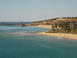
Christie's Beach near Adelaide |
||
| Waters | Great Australian Bay | |
| Land mass | Australia | |
| Geographical location | 34 ° 29 ′ S , 138 ° 15 ′ E | |
|
|
||
| width | 75 km | |
| depth | 145 km | |
The Gulf Saint Vincent is about 145 kilometers long and 75 kilometers wide indentation of the Indian Ocean on the coast of the Australian state of South Australia . In the southeast it is bounded by the Fleurieu Peninsula , and in the west by the Yorke Peninsula from the Spencer Gulf . In front of the Gulf Saint Vincent is the island of Kangaroo Island .
Adelaide , the capital of the state of South Australia, is located on the east coast of the bay. Other major cities are Ardrossan , Port Wakefield , Edithburgh and Port Vincent .
The Gulf was discovered in 1802 by the English explorer Matthew Flinders with his ship Investigator and named in honor of Admiral John Jervis, 1st Earl of St. Vincent .
Numerous crustaceans and poly-bristles , sea cucumbers and sea urchins live in the Gulf . The benthos is formed by soft sediment deposits that are populated by seaweeds in the area of the mouth of the Port River .

