Hüttenkofen (Mengkofen)
|
Hüttenkofen
municipality Mengkofen
Coordinates: 48 ° 44 ′ 37 " N , 12 ° 28 ′ 31" E
|
|
|---|---|
| Incorporation : | May 1, 1978 |
|
Location of the municipality of Hüttenkofen in what was then the
district of Dingolfing |
|
|
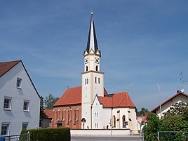
The Church of the Assumption
|
|
Hüttenkofen is a part of the municipality Mengkofen in the Lower Bavarian district of Dingolfing-Landau . Until 1978 it formed an independent municipality.
location
Hüttenkofen is located on the Aiterach three kilometers northeast of Mengkofen on the state road 2141.
history
Own noblemen resided in Hüttenkofen until 1410, of whom the last Ruger was the Haunberger from Hüttenkofen. The Haunbergers should then have moved to Tunzenberg .
Lessons were given in Hüttenkofen as early as the 17th century, and a school was established in 1860. The municipality of Hüttenkofen, which belonged to the Dingolfing district , was merged into the Mengkofen municipality on May 1, 1978.
Attractions
- Church of the Assumption of the Virgin of the Hüttenkofen branch. From the Gothic building from around 1400, the choir and the tower substructure have been preserved. In 1714, 1720 and 1721 the church was redesigned in baroque style, including a dome in place of the pointed helmet. The neo-Gothic brick nave with ribbed vaults in the choir was built in 1852 according to plans by Leonhard Schmidtner . In 1866 the church tower, which until then had a dome, was given a point again. The furnishings are neo-Gothic with wooden figures from around 1500.
education and parenting
- House for children Hüttenkofen. The crèche and a kindergarten group are located in the former schoolhouse.
societies
- Hüttenkofen volunteer fire department
- KLJB Hüttenkofen-Puchhausen
- KSK Hüttenkofen
- Country women group Hüttenkofen
- Hüttenkofen fruit and horticultural association
- Scout group Hüttenkofen-Puchhausen

