Hangzhou Bay
| Hangzhou Bay 杭州 湾 |
||
|---|---|---|
| Waters | East China Sea | |
| Land mass | Asia | |
| Geographical location | 30 ° 17 '7 " N , 120 ° 55' 28" E | |
|
|
||
| Tributaries | Qiantang Jiang | |
|
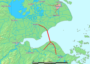
Hangzhou Bay ( 杭州 灣 / 杭州 湾 , Hángzhōu Wān ) and bridge connection |
||
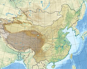
The Hangzhou Bay or Bay of Hangzhou ( Chinese 杭州 灣 / 杭州 湾 , Pinyin Hángzhōu Wān , English Hangzhou Bay ) is located at the confluence of the Qiantang Jiang in the East China Sea between the northeast of Zhejiang Province and the southeast of the government-immediate city of Shanghai .
The eponymous city of Hangzhou is located at the western end of the bay. To the east of the mouth of the bay are the many small islands of the Zhoushan archipelago .
Hangzhou Bay is known for its tidal wave , which at the mouth of the Qiantang River as spring tide ( 錢塘江 大潮 / 钱塘江 大潮 , Qiántáng Jiāng Dàcháo , English Qiantang River Tide ) is up to eight meters high and with a speed of up to 30 km / h occurs.
Bridge connection across Hangzhou Bay
The bay has been spanned by a long bridge connection, the Hangzhou Wan Daqiao , since May 1, 2008 . The Hangzhou Wan Bridge is officially the world's second longest bridge with a length of 35.673 km that spans the open sea.
Web links
- Zhejiang Provincial Government Official Website (Chinese)
- Official website of the Zhejiang Provincial Government (German)
- Info page about Hangzhou (English)
Individual evidence
- ↑ Qiantang River Tide 01, accessed August 1, 2018 - Online ( Memento from September 10, 2008 in the Internet Archive ) www.hangzhoubaybridge.com (English)
- ↑ Qiantang River Tide 02: (English) [1] on hangzhoubaybridge.com, accessed August 1, 2018 - online
- ↑ Hangzhou Wan Bridge / Hangzhou Bay Bridge: (English) [2] on structurae.net, accessed on August 1, 2018 - online
- ↑ List of the longest bridges

