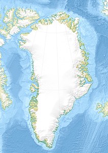
Hans Tausen ice cap
| Hans Tausen ice cap | ||
|---|---|---|
|
Satellite photo of Peary Land with the Hans Tausen ice cap west of the ice-free area |
||
| location | North Greenland | |
| Type | icecap | |
| length | 100 km | |
| surface | approx. 4000 to 4200 km² | |
| Altitude range | 1300 m - 0 m | |
| width | Max. 80 km | |
| Ice thickness | Max. 600 m | |
| Coordinates | 82 ° 30 ′ N , 37 ° 30 ′ W | |
|
|
||
The Hans Tausen Ice Cap ( Danish Hans Tausen Iskappe ) is the second largest ice cap in North Greenland and the largest in Peary Land . It is one of the northernmost ice caps in the world and one of the few whose outlet glaciers calve directly into the Arctic Ocean . The namesake Hans Tausen was a Danish reformer of the 16th century.
geography
The extent of the Hans-Tausen ice cap is 75 to 100 km in north-south direction and 50 to 80 km in east-west direction. It is bounded in the south by the Wandeltal and is only 20 km away from the northern edge of the Greenland Ice Sheet . The ice cap ends here at a height of 500 m. In the west and north, the outlet glaciers flow directly into the J. P. Koch Fjord and the O. B. Bøggild Fjord. The Adolf Jensen Fjord penetrates more than 25 km into the ice cap area from the north. In the east it is separated from the Heimdal and Bure ice caps by the Odinfjord.
The size of the Hans-Tausen ice cap is given as 4208 km² or 3975 km². In its central part it reaches heights of over 1300 m. The ice thickness varies between 300 m in the southern and 100 to 400 m in the northern part. A thickness of 600 m was measured over a valley running in north-south direction.
Icing history
During the last Ice Age, the Hans Tausen Ice Cap was likely associated with the Greenland Ice Sheet and ice caps over northern Peary Land. After the beginning of the Holocene , the ice began to melt about 10,000 years ago, which at the latest 8100 years ago led to the Hans-Tausen-Plateau being free of ice. Today's Hans Tausen ice cap is only 3500 to 4000 years old, as ice drillings have shown. The re-glaciation of the area continued until the beginning of the 20th century and then stalled or receded slightly.
literature
- Claus Uffe Hammer (Ed.): The Hans Tausen Ice Cap (= Meddelelser om Grønland . Volume 39 ). Museum Tusculanum Press, 2001, ISBN 87-635-1255-6 ( limited preview in Google book search).
- Anne Munck Solgaard: Hans Tausen Iskappe, North Greenland. Studies Using an Ice Flow Model (PDF; 13.3 MB), Master thesis, Niels Bohr Institute, University of Copenhagen, 2008
Individual evidence
- ↑ a b c d e Anthony K. Higgins: North Greenland Glacier Velocities and Calf Ice Production (PDF; 3.5 MB). In: Polarforschung 60, Heft 1, 1990 (published 1991), pp. 1-23
- ↑ a b c d Jon Y. Landvik, Anker Weidick, Anette Hansen: The glacial history of the Hans Tausen Iskappe and the last glaciation of Peary Land, North Greenland (PDF; 2.7 MB). In: Meddelelser om Grønland, Geoscience 39, 2001, pp. 27-44 ( limited preview in Google book search)
- ^ A b N. Reeh, OB Olesen, HH Thomsen, W. Starzer, CE Bøggild: Mass balance parameterisation for Hans Tausen Iskappe, Peary Land, North Greenland. In: Meddelelser om Grønland, Geoscience 39, 2001, pp. 57-69 ( limited preview in Google book search)
- ↑ a b c d e f Solgaard, 2008, p. 2
- ↑ Solgaard, 2008, p. 48

