Harcuvar Mountains
| Harcuvar Mountains | ||
|---|---|---|
| Highest peak | Smith Peak ( 1598 m ) | |
| location | Arizona , United States | |
|
|
||
| Coordinates | 33 ° 57 ′ N , 113 ° 35 ′ W | |
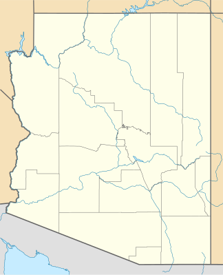
The Harcuvar Mountains ( Yavapai : Ahakuwa ) are a mountain range in Yavapai and La Paz Counties in the state of Arizona in the United States .
geography
The mountains lie within the Sonoran Desert in the west of the state and run for about 40 to 45 km from northwest to southeast. The highest point is Smith Peak with a height of 1598 m . In the northwest they are surrounded by the Butler Valley and in the southeast by the McMullen Valley . The area is difficult to access, the only road is the Alamo Road , which branches off US Highway 60 at Wenden and crosses the mountains over the Cunningham Pass . Part of the Harcuvar Mountains is protected by the Harcuvar Mountains Wilderness .
Web links
- Harcuvar Mountains in the United States Geological Survey's Geographic Names Information System
- Harcuvar Mountains on Peakbagger.com (English)
Individual evidence
- ↑ Harcuvar Mountains on Peakbagger.com (English)
- ↑ Harcuvar Mountains Wilderness , Bureau of Land Management, accessed July 26, 2019
