Hartland Point
Coordinates: 51 ° 1 ′ 18 ″ N , 4 ° 31 ′ 31 ″ W.
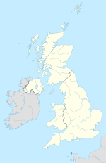
Hartland Point is a headland in England and the most north-westerly point in the Devon region , apart from Lundy Island . It marks the western limit of Bideford Bay . The point is also known as the farthest point from a railway line in England, which is only 14 miles away in Bude . The place marks the southwestern limit of the Bristol Channel . The northwesternmost limit of the canal is St Ann's Head near Milford Haven , 40 miles away. The place has been an important place for communication and navigation for over 130 years.
lighthouse
The lighthouse at Hartland Point was built in 1874 and officially opened by the Bishop of Exeter . It was operated manually by four guards who lived with their families in the lighthouse. The rotating light was operated by a clockwork, which had to be rewound every two and a half hours. The lighthouse was automated in 1984 and therefore without the need for constant watch. Today the lighthouse is maintained and monitored by the Trinity House Lighthouse Service . Today's light, which emits six light signals every 15 seconds, has a range of 25 miles. A fog horn emits a five-second loud tone every 60 seconds in fog that can be heard from over two miles away. The lighthouse warns sailors about this headland and is a waypoint for ships on their way through the Bristol Channel. In the sloping terrain near the lighthouse there is a disused water collection system for it. The original road to the lighthouse has now been broken off. Today the tower can only be reached by off-road vehicle and helicopter, but not open to the public.
Coast Guard observation post
The observation post was manned until 1983 when the watch was moved to Hartland . The post in Hartland Point now monitors ship traffic completely automatically with the help of radio transmitters and receivers. The station is only manned in certain bad weather conditions.
radar
During the Second World War and for a while afterwards, a radar station was operated in Hartland Point to detect low-flying objects and ships. Only the foundation walls of this old radar can be seen. A new radar was built in 1994 and is used for air surveillance.
Johanna
The Panama- registered coastal ship Johanna ran aground on the cliffs of Hartland Point on December 31, 1982, just 100 m from the lighthouse. Four crew members were rescued with a rescue helicopter . The three officers were then rescued from Clovelly in a lifeboat . The ship was loaded with loose wheat and was on its way from Holland to Barry Island . Today only a few very rusty remains of the ship can be seen on the cliffs.

