Haskell (Indiana)
| Haskell | ||
|---|---|---|
|
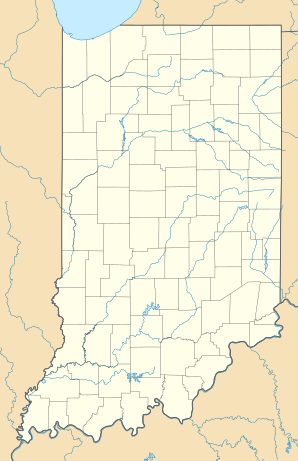
Location in Indiana
|
||
| Basic data | ||
| State : | United States | |
| State : | Indiana | |
| County : | LaPorte County | |
| Coordinates : | 41 ° 29 ′ N , 86 ° 54 ′ W | |
| Time zone : | Central ( UTC − 6 / −5 ) | |
| Height : | 233 m | |
| GNIS ID : | 435860 | |
Haskell is an unincorporated community in LaPorte County , Indiana in the United States .
geography
The place is at the intersection of two railway lines; on the one hand the Grand Trunk Railroad (now a route of the Canadian National Railway ) running in the west-east direction and the no longer existing north-south connection of the Louisville and Nashville Railroad , west of US Highway 421 about halfway between Wanatah and Westville .
history
Haskell was originally called Haskell Station and was built as a railroad settlement in the 1850s. The settlement was likely named after James Haskell, one of the first white settlers. In 1857, a post office was set up in Haskell in 1857 and remained in operation until its closure in 1937.
supporting documents
- ^ Haskell ( English ) In: Geographic Names Information System . United States Geological Survey . Retrieved December 12, 2018.
- ^ Jasper Packard: History of La Porte County, Indiana, and Its Townships, Towns and Cities . SE Taylor, printers, 1876, p. 141.
- ^ Ronald L. Baker: From Needmore to Prosperity: Hoosier Place Names in Folklore and History . Indiana University Press, October 1995, ISBN 978-0-253-32866-3 , p. 160: "James Haskell, one of the early settlers ..."
- ^ ED Daniels: A twentieth century history and biographical record of La Porte County, Indiana . Lewis Publishing Co., 1904, p. 104.
- ^ LaPorte County ( English ) Jim Forte Postal History. Retrieved December 12, 2018.
