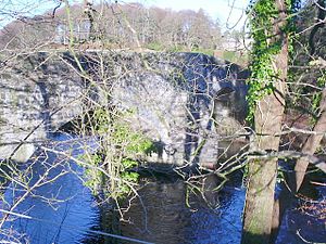
Haugh Bridge
Coordinates: 54 ° 58 ′ 27 " N , 3 ° 52 ′ 4" W.
| Haugh Bridge | ||
|---|---|---|
| Haugh Bridge | ||
| use | Road bridge | |
| Convicted | Back road | |
| Subjugated | Urr Water | |
| place | Haugh of Urr | |
| construction | Stone arch bridge | |
| Number of openings | 2 | |
| completion | around 1763 | |
| location | ||
|
|
||
The Haugh Bridge is a road bridge in the Scottish village of Haugh of Urr in the Council Area Dumfries and Galloway . In 1971 the structure was included in the Scottish monument lists in the highest monument category A. Furthermore, the Haugh Bridge, together with a bridge over the Spottes Burn and the Bridgend House, form a category B monument ensemble.
description
The Haugh Bridge, located on the southern edge of the Haugh of Urr, was built around 1763 as part of a military road. The masonry viaduct made of quarry stone leads a side road leading to Castle Douglas over the Urr Water . The approximately 30 m long arch bridge spans the river with two lined segment arches . During a restoration in the course of the 19th century, they may have been re-bricked. Pointed icebreakers emerge from the pillar on both sides . They run into shallow alternative bays for pedestrians. Brick parapets with natural stone caps limit the roadway. They fan out on the driveways.
Individual evidence
- ↑ a b Listed Building - Entry . In: Historic Scotland .
Web links
- Entry on Haugh Bridge in Canmore, Historic Environment Scotland database

