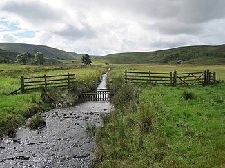
Howgill Beck (Tindale Tarn)
| Howgill Beck | ||
|
The Howgill Beck |
||
| Data | ||
| location | Cumbria , England | |
| source | north of Cold Fell 54 ° 54 ′ 29 ″ N , 2 ° 37 ′ 9 ″ W |
|
| muzzle | in the Tindale Tarn coordinates: 54 ° 55 ′ 15 ″ N , 2 ° 37 ′ 20 ″ W 54 ° 55 ′ 15 ″ N , 2 ° 37 ′ 20 ″ W
|
|
The Howgill Beck is a watercourse in Cumbria , England .
The Howgill Beck arises north of the Cold Fell from a number of unnamed source rivers. It initially flows in a northwesterly direction, but turns east of Howgill in an easterly direction, in which it flows up to its confluence with the Tindale Tarn .
swell
- Haltwhistle and Brampton, Bewcastle and Alston (= Landranger Map . Band 86 ). Ordnance Survey , Southampton 2009, ISBN 978-0-319-23166-1 .
