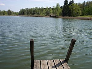
Husemersee
| Husemersee | ||
|---|---|---|

|
||
| Geographical location | Canton Zurich | |
| Tributaries | Wattbach | |
| Drain | Bruggbach → Mederbach → Thur | |
| Places on the shore | Ossingen | |
| Data | ||
| Coordinates | 695 175 / 275 354 | |
|
|
||
| Altitude above sea level | 409 m above sea level M. | |
| surface | 8 ha | |
| volume | 499,000 m 3 | |
| Maximum depth | 14 m | |
|
particularities |
Flat moor of national importance |
|
The Husemersee , also Husemer See or Hausersee , is located north of the village center of the municipality of Ossingen in the Swiss canton of Zurich .
geography
The Husemersee belongs to the Andelfinger Seenplatte in the Zürcher Weinland and is fed by the Wattbach . The tote lake is 409 m above sea level. M. in a nature reserve in the forest and is 14 meters deep. There are other small ponds to the east of the lake.
In the area around the lake, peat was cut industrially during the two world wars . The reed areas around the lake and the neighboring little lakes were added to the list of flat moors of national importance in 1994 .
Development
A hiking trail leads around the lake. The time required to circumnavigate the lake is around three quarters of an hour. You can swim on the west side of the lake. There is a jetty, a lawn for sunbathing and a fireplace.
reachability
Husemersee can be reached on foot from Ossingen train station in a good half an hour. Drivers can park their vehicle in the parking lot at the edge of the forest.
Web links
- Husemersee on schweizersee.ch
- Information sheet from the Office for Waste, Water, Energy and Air (PDF)

