Hwanggŭmp'yŏng
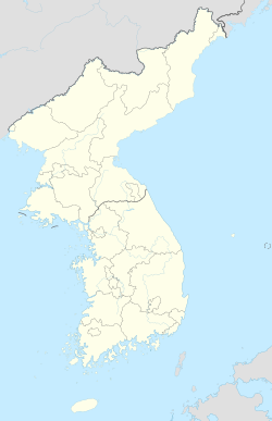
Location of Hwanggŭmp'yŏng in Korea |
| Chinese name | |
|---|---|
| Traditional : | 黃金 坪 島 |
| Simplified : | 黄金 坪 岛 |
| Pinyin : | Huángjīnpíng Dǎo |
| Wade-Giles : | Huang-chin-p'ing Tao |
| Korean name | |
| korean alphabet : | 황금평 |
| Chinese characters : | 黃金 坪 |
| Revised Romanization : | Hwanggeumpyeong |
| McCune-Reischauer : | Hwanggŭmp'yŏng |
Hwanggŭmp'yŏng is an island in the Yalu / Amrok River on the border between North Korea and the People's Republic of China . It has an area of 11.45 square kilometers and belongs to the North Korean province of P'yŏngan-pukto .
location
Hwanggŭmp'yŏng belongs together with Pidan-sŏm (비단섬 緋 緞 島), Saho-sŏm (서호 섬 西湖 島) and other islands to the Sin-dogun (신도 군 薪 島 郡) group of islands , the westernmost part of Korea.
Hwanggŭmp'yŏng is Korean territory under the 1962 Border Treaty, although the island is closer to the Chinese bank of the river as it is inhabited by Koreans.
Free trade area
Following an agreement between North Korea and China in June 2011, a joint special economic zone was set up on the islands of Hwanggŭmp'yŏng and Wihwa and in the Chinese border area near Dandong . The relevant work was completed in 2013 and an area of more than 120 hectares is to function as a free trade zone from 2015.
Footnotes
- ↑ Jeong Woo-sang: What Is Hwanggumpyong Island? , Digital Chosun. June 10, 2011. Accessed March 1, 2012.
- ↑ Robert Kelley, Michael Zagurek, Bradley O. Babson: China's Embrace of North Korea: The Curious Case of the hwanggumpyong island Iceland Economic Zone . In: 38 North . US-Korea Institute, Johns Hopkins University School of Advanced International Studies. February 19, 2012. Retrieved March 1, 2012.
- ^ Nick Hansen, Jeffrey Lewis, New Construction Activity at the Hwanggumpyong Economic Zone . In: 38 North . US-Korea Institute, Johns Hopkins University School of Advanced International Studies. June 17, 2013. Retrieved June 22, 2013.
Coordinates: 39 ° 52 ' N , 124 ° 15' E
