Ilhéu das Cabras
| Ilhéu das Cabras | ||
|---|---|---|
| Waters | Gulf of Guinea | |
| Geographical location | 0 ° 24 '30 " N , 6 ° 42' 55" E | |
|
|
||
| length | 940 m | |
| width | 240 m | |
| Highest elevation | 90 m | |
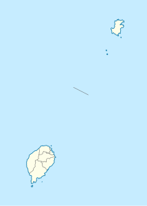
Ilhéu das Cabras is a small island in the Gulf of Guinea belonging to the West African state of São Tomé and Príncipe . It is located 2.1 km east-northeast of Micolo on the northeast coast of the main island of São Tomé , and three kilometers north of São Tomé Airport . It is not permanently inhabited and belongs to the Lobata district .
The island is of volcanic origin ( stratovolcano ). It consists of two hills, both of which reach a height of 90 meters. There is a five meter high lighthouse on the northeast hill.
Individual evidence
- ↑ Sailing Directions (Enroute), Pub. 123: Southwest Coast of Africa (PDF). Sailing Directions. United States National Geospatial-Intelligence Agency. 2017, p. 77
Web links
- Ilhéu das Cabras on travelingluck.com (Portuguese)
