Ilha do Mel
| Ilha do Mel | ||
|---|---|---|
| Aerial photograph | ||
| Waters | Atlantic Ocean | |
| Geographical location | 25 ° 31 ′ 48 ″ S , 48 ° 18 ′ 57 ″ W | |
|
|
||
| length | 10 km | |
| width | 4.5 km | |
| surface | 27.62 km² | |
| Highest elevation |
Morro Bento Alves of Morro do Miguel 151 m |
|
| Residents | 1000 36 inhabitants / km² |
|
| main place | Nova Brasília | |
The Ilha do Mel is an island off the coast of Brazil in the Bay of Paranaguá in the state of Paraná with an area of 27.62 km² and around 35 km of beach line . The island has about 1,000 inhabitants and is located about 115 km east of Curitiba in the district of Paranaguá.
Naming
There are different theories about how the island got its name
- Before the Second World War , the island is said to have been known as the island of Admiral Mehl , who frequently visited the island with his family
- Retired seafarers kept beekeeping and exported honey on the island
- The island's water contains mercury . When it comes into contact with salt water , it takes on a color similar to honey
- The Indian inhabitants already kept bees and practiced beekeeping.
geography
The island has the shape of a crooked 8 and consists of a northern and southern part, which are connected by a very narrow stretch of beach. Due to coastal erosion and the current rise in sea levels , the island will one day be divided at this point. The circumference of the island is 35 km.
While the northern part of the island is flat, the southern part has the following elevations :
- Morro Bento Alves of Morro do Miguel (151 m)
- Morro do Meio (94 m)
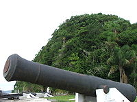
- Morro da Baleia (80 m). This is where the fortress is located.
- Morro das Encantadas (68 m)
- Morro do Joaquim (65 m)
- Morro do Farol de Conchas (50 m)
To the east of the island is the open sea, to the southwest is the Pontal do Sul lido and to the north are the two islands of Ilhas das Peças and Superagüi .
The fortress
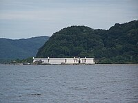
The Fortaleza de Nossa Senhora dos Prazeres fortress, about 3 km from Nova Brasília, was built by slaves to defend the Bay of Paranaguá from 1767 to 1769 by order of the Portuguese King Dom João V and is one of the largest from the colonial days of Brazil. It has been restored and is now an open-air museum .
tourism
Ilha do Mel is a major tourist destination in Paraná and tourism is the island's main source of income.
There are countless mostly simple and inexpensive small pousadas . More than 90% of the island is under nature protection, which is one of the reasons why the number of visitors is limited to a maximum of 5,000 people per day, although this is not adequately controlled.
The best time to visit the island is between December and March in the summer as it rains a lot during the other months.
The best beaches for bathing are Praia do Limoeira , Praia da Fortaleza , Praia das Conchas , Praia do Farol , Praia Grande and Praia do Miguel . The Praia de Fora is particularly suitable for surfing , and to a limited extent also the Praia Grande . Boat trips (water taxi), jet skiing and kite surfing are offered at Praia do Istmo . Paragliding is also offered at the Prainha in Encantada . You can borrow bikes from Praia do Limoeiro (and in the village of Vila do Farol ). The beach section Cassual or Ponta do Bicho is very suitable for watching dolphins and turtles . The majority of restaurants and pousadas are located on the beaches of Brasília and Encantadas .
Attractions
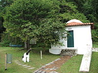
- The Farol das Conchas , which was built in 1872 on the orders of Dom Pedro II on the easternmost tip of the island and is still in operation, is a landmark for shipping at the entrance to Baía de Paranaguá .
- The fortress Fortaleza de Nossa Senhora dos Prazeres can be reached from Nova Brasília via the beach at low tide, at high tide part of the way has to be covered inland.
- The Encantadas Grotto ( Gruta das Encantadas ), around which various legends are entwined, is located in the extreme south of the island.
Infrastructure and traffic
The island is about 27 km from the port town of Paranaguá and about 4.5 km from the Pontal do Sul lido, where there is an information center. There are feeder boats to the island every hour from Pontal do Sul (duration of the crossing approx. 30 minutes) or 2 to 3 times a day from Paranaguá (duration of the crossing approx. 90 minutes) to the two main landing stages on the beaches of Nova Brasília and Encantadas .
Ilha do Mel does not have a complete infrastructure - the fixed power grid has only existed for a few years. There are 2 health and police stations on the island as well as a school up to 8th grade and various retail shops.
The island is car-free and the paths are often unpaved; no further development has been carried out, especially in the nature reserve. The routes on the island are covered either on foot or by boat. There are numerous hiking trails, some of which lead to Encantadas directly on the water over rocks and are therefore difficult or impossible to pass at high tide.


