Paranaguá
| Paranaguá | ||
|---|---|---|
|
Coordinates: 25 ° 31 ′ S , 48 ° 31 ′ W Paranaguá on the map of Brazil
|
||
| Basic data | ||
| Country | Brazil | |
| State | Paraná | |
| City foundation | July 29, 1648 | |
| Residents | 140,469 (2010) | |
| City insignia | ||
| Detailed data | ||
| surface | 826.674 km 2 | |
| Population density | 170 people / km 2 | |
| height | 5 m | |
| Waters | Atlantic | |
| Time zone | UTC −3 | |
| City Presidency | Edison Kersten ( PMDB ) (2013-2016) | |
| Website | ||
| Paranaguá on the map of Paraná | ||
The port city of Paranaguá , officially Município de Paranaguá , is located in the Brazilian state of Paraná in the Bay of Paranaguá on the Atlantic Ocean .
Paranaguá is the supply and shipping port of Curitiba , the capital of the state, which is around 90 km west of Paranaguá at an altitude of 934 m above sea level. According to the 2010 census, the population was 140,469, according to the estimate of July 1, 2013: 148,232 Parnaguans.
history
Founded in 1648, Paranaguá is the state's oldest city. It still preserves some colonial buildings, churches and a Jesuit college from 1736.
Economy and port
Paranaguá is a typical Brazilian port city with around 150,000 inhabitants, which lives from the port and fishing. It is Brazil's most important export port for agricultural goods, such as B. Soybeans. Vehicles of the Audi brand, which are manufactured in Curitiba , are also exported from there .
The port of Porto de Paranaguá is also known for the fact that the government of Paraguay has a duty-free mooring quay in the port of Paranaguá and is allowed to use it without restriction according to the state treaty. All imports and exports for Paraguay go through this port. All goods for Paraguay are brought by truck to the central warehouse in Ciudad del Este on the Rio Paraná in the triangle of the Iguazu Falls and from there distributed to the state.
The port also has the large, fast-growing container terminal TCP (Terminal de Contêineres de Paranaguá SA), which is operated privately. While 252,679 TEU containers were imported and exported in 2000 and 595,261 in 2007, the throughput increased to 739,818 TEU in 2013, and in 2013 the port handled a total of 46,168,102 tons.
In Paranaguá there is also a huge slaughterhouse that supplies the capital with fresh meat. The Port Authority of Paranaguá, Administração dos Portos de Paranaguá e Antonina (Appa), is also responsible for the small neighboring port of Antonina .
Paranaguá Railway
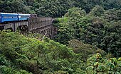
The 110 km long railway line between Curitiba and Paranaguá is considered an engineering masterpiece of the late 19th century. The railway was designed by Ferdinand de Lesseps , the builder of the Suez Canal , built according to his plans and completed in 1885. The route of the narrow-gauge railway is single-lane and overcomes the height difference of 951 m over a length of 80 km. It has 15 train stations and runs over 13 tunnels cut into the rock, 41 steel viaducts imported from Belgium and 32 bridges. This rail connection is longer than the road connection, as the height difference is overcome with switchbacks . There were a number of hairpin bends that can only be negotiated with shortened (6 wagons) trains, as the rugged mountains (the "Serra do Mar") meant that there wasn't enough space to make the hairpin bends more generous. In the meantime, the hairpin bends and tight bends have been rebuilt so that even long freight trains - even if only at a snail's pace - made their way up to Curitiba. However, the journey by passenger train (once a day) was still spectacular and slow; the drive from Morretes to Curitiba took 3 hours, the bus only takes an hour.
The Paranaguá Railway has not been running for several years (as of 2017). The tracks and the ruined railway station in Paranaguá still exist, but everything is left to decay.
Diocese of Paranaguá
The diocese Paranaguá was on July 21, 1962 by Pope John XXIII. built with the Apostolic Constitution Ecclesia sancta from cessions of territory of the Archdiocese of Curitiba .
Town twinning
sons and daughters of the town
- Júlia da Costa (1844-1911), Brazilian poet
- Brasílio Itiberê da Cunha (1846–1913), composer
- Karoline de Souza (* 1990), handball player
Web links
- City Prefecture website (Portuguese)
- City Council website (Portuguese)
- Port Authority of Paranaguá and Antonina
Individual evidence
- ↑ a b Instituto Brasileiro de Geografia e Estatística (IBGE): Cidades @ Paraná: Paranaguá . Retrieved June 17, 2014 (Portuguese).
- ↑ Movimentação de Cargas nos Portos do Paraná - December 2013 . Retrieved June 17, 2014 (Portuguese; PDF; 60 kB).
- ↑ Prefeitura Municipal de Paranaguá: Comitiva japonesa chega a Paranaguá nesta quarta-feira, dia 24 of November 23, 2010. Accessed on June 17, 2014 (Portuguese).
- ^ Prefeitura Municipal de Paranaguá: Baka vê na Ucrânia grandes possibilidades de negócios . Retrieved June 17, 2014 (Portuguese).


