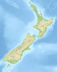
1968 Inangahua earthquake
| 1968 Inangahua earthquake | ||
|---|---|---|
|
|
||
| Coordinates | 41 ° 45 '36 " S , 171 ° 57' 36" O | |
| date | May 24, 1968 | |
| Time | 05:24 | |
| intensity | 10 on the MM scale | |
| Magnitude | 7.1 M W | |
| depth | 10 km | |
| epicenter | near Īnangahua
(40 km east of Westport)
|
|
| country | New Zealand | |
| Affected places | ||
| Tsunami | No | |
| dead | 3 | |
| damage | NZ $ 39 million | |
|
|
||
The 1968 Inangahua earthquake on the South Island of New Zealand was initially underestimated. Only gradually did the extent of the damage become known, which took years to repair.
geography
The center of the quake was near the small town of Īnangahua , about 35 km west of Murchison and about 40 km east of Westport .
The quake
On May 24, 1968 at 5:24 a.m., the approximately 300 residents of the small towns of Īnangahua and Īnangahua Junction were shaken awake by an earthquake measuring 7.1 in the morning. Initial assumptions were based on a relatively weak earthquake. But it turned out that all access roads as well as all power and telephone connections were interrupted. Numerous landslides blocked roads and rivers. Around 50 bridges in the region were damaged or destroyed.
The situation became threatening 6 km upstream of the Buller River behind Īnangahua. A massive landslide had dammed the river over 7 km and let it rise to a height of 30 m. From Īnangahua to Westport, all residents of the valley had to be evacuated immediately. Since Īnangahua and Īnangahua Junction were cut off from the outside world, 235 residents had to be flown out by helicopter , 50 more set off on foot to the safer Reefton . But the river flooded the dam , eroded away the earth and cleared its river bed on its own without generating a flood.
Repairs to the damage took several years to complete, as all roads and bridges had to be repaired or rebuilt, and in addition to two locomotives that had been thrown off the tracks, over 100 km of new track systems were laid. In Īnangahua, around 70% of the houses were damaged to the point of being uninhabitable. In other parts of the region, the houses were mostly made of wood and had weathered the quake quite well. Therefore, the damage to the houses was mainly concentrated on the interior fittings and the brick chimneys.
In the month following the quake, 15 additional aftershocks with a magnitude of 5 and above were registered in addition to smaller quakes.
In-depth investigations into the faults revealed that the main earthquake originated from the so-called " blind fault " (invisible fault), which is referred to there as the Rotokohu Fault . Furthermore, it turned out that in addition to the visible fractures on the surface, the Lyell Fault to the west and the Inangahua Fault had also been activated during the quake.
It is interesting, among other things, that no information was given about damage in the hard coal and gold mining in and around Reefton.
See also
literature
- Nicola McCloy: New Zealand Disasters . Whitcoulls Ltd., Auckland 2004, ISBN 1-877327-34-4 (English).
- Rebecca Ansell, John Taber: Caught in the Crunch - Earthquakes and Volcanoes in New Zealand . Harper Collins Publishers (NZ) Ltd., Auckland 1996, ISBN 1-86950-201-9 (English).
Web links
- M 7.1, Inangahua, May 24, 1968. GeoNet - GNS Science , accessed April 7, 2013 .
- Story: Historic earthquakes - The 1968 Īnangahua earthquake. e Ara - The Encyclopedia of New Zealand, accessed March 4, 2010 .
Individual evidence
- ↑ M 7.1, Inangahua, 24 May 1968. GeoNet - GNS Science , accessed on April 7, 2013 (English).
- ↑ New Zealand Disasters - Inangahua Earthquake. Christchurch Library, accessed March 4, 2010 .
- ^ Robert S. Yeats: The 1968 Inangahua, New Zealand, and 1994 Northridge, California, earthquakes: implications for northwest Nelson . In: New Zealand Journal of Geology & Geophysics . Vol. 43, 2000, pp. 587-599 (English).

