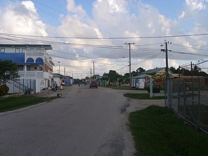
Independence and Mango Creek
| Basic data | |
|---|---|
| Greater Region: | Stann Creek District |
| Belize | |
| Status: | Census community |
| Residents : | 4.014 |
| Area : | |

|
|
Independence and Mango Creek are neighboring villages that form a village for census reasons . The place is in the border area of the Stann Creek District and Toledo District of Belize .
geography
The settlement is on the coast, in the Bay of Placencia . A road connects the place with the Southern Highway , which runs further inland. This spur road follows the course of Big Creek and the district boundary, which run south of the road. Mango Creek runs north of the city . There are numerous farms in the lowlands near the coast.
population
In 2000, Independence and Mango Creek had a population of 2,929 people. Compared to surrounding places, the village is quite large. In 2010 the population was given as 4,014 people.
There are 2 primary schools, a secondary school and a college, where young people from surrounding areas are also in the boarding school.
traffic
The site provides access to the Alabama Wharf and Big Creek deep water docks , which provide access to the Caribbean Sea across Placencia Bay . There is also a small airport: Independence and Mango Creek Airport (INB ⊙ ). To the south, there are other settlements along the coast, such as Big Creek, which itself has its own airport ( ⊙ ).
Individual evidence
- ↑ geonames.org .
- ↑ orbitz.com ; geonames.org .
- ↑ geonames.org : Big Creek Airport.
Web links
Coordinates: 16 ° 32 ′ 0 ″ N , 88 ° 25 ′ 0 ″ W.