Isla Coronado
| Isla Coronado (Isla Smith) | ||
|---|---|---|
|
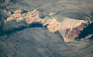
ISS astronaut photo of Isla Coronado (north is right) |
||
| Waters | Canal de las Ballenas, Gulf of California | |
| Geographical location | 29 ° 4 '12 " N , 113 ° 30' 28" W | |
|
|
||
| length | 7.2 km | |
| width | 2.5 km | |
| surface | 8.385 km² | |
| Highest elevation |
Volcán Coronado 440 m |
|
| Residents | uninhabited | |
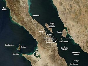
| The islands in the north of the Gulf of California. Coronado is named Smith on it. | ||
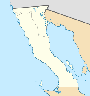
Isla Coronado , also Isla Smith or Smith Island , is a Mexican volcanic island in the Gulf of California . Administratively, like the larger neighboring island of Ángel de la Guarda, it belongs to the municipality ( municipio ) Mexicali of the state of Baja California (" Baja California ") and within it to the municipality ( delegación ) San Felipe, although it is hundreds of kilometers south of the mainland part of the city. The island is not to be confused with Isla Coronados in the south of the Gulf of California.
geography
Isla Coronado is located just 3 km east of the Baja California peninsula in the Canal de las Ballenas , which separates the island of Ángel de la Guarda from Baja California. The island is 7.2 km long, up to 2.5 km wide and has an area of 8.4 km². The northernmost part of the island is completely occupied by the Coronado volcano ( Volcán Coronado ), an approximately 440 m high stratovolcano , while the southern end is only connected to the island via a narrow isthmus . The arid and uninhabited island is part of the UNESCO World Natural Heritage "Islands and Protected Areas in the Gulf of California" ( Spanish Islas y áreas protegidas del Golfo de California ).
Web links
- Coronado in the Global Volcanism Program of the Smithsonian Institution (English)
- Article about Coronado in NASA Earth Observatory (English)


