Islas Coronado
| Islas Coronado | ||
|---|---|---|
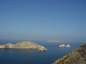
| View from Coronado Sur to the other Coronados | ||
| Waters | Pacific Ocean | |
| Geographical location | 32 ° 26 ′ N , 117 ° 16 ′ W | |
|
|
||
| Number of islands | 4th | |
| Main island | Coronado Sur | |
| Total land area | 2.52 km² | |
| Residents | uninhabited | |
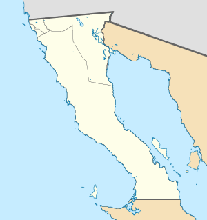
| Topographic map | ||
The Islas Coronado form an uninhabited group of islands off the coast of the Mexican state of Baja California , not far from the city of Tijuana .
Islands
![]() Map with all coordinates: OSM | WikiMap
Map with all coordinates: OSM | WikiMap
| island | Area ( ha ) |
Length m |
Width m |
Height m |
Coordinates |
|---|---|---|---|---|---|
| Coronado Norte | 48 | 1510 | 400 | 153 | 32 ° 26 '23.0 " N , 117 ° 17' 50.0" W. |
| Pilon de Azucar | 7th | 340 | 120 | 33 | 32 ° 25 '28.0 " N , 117 ° 15' 47.0" W. |
| Coronado Centro | 14th | 660 | 410 | 32 | 32 ° 25 '02.0 " N , 117 ° 15' 35.0" W. |
| Coronado Sur | 183 | 3580 | 610 | 220 | 32 ° 24 '19.0 " N , 117 ° 14' 43.0" W. |
| Islas Coronado | 252 | 220 |
history
In September 1542 Juan Rodríguez Cabrillo named the islands Islas Desiertas ( Eng . "Deserted islands"). In 1602, Sebastián Vizcaíno changed the name of the island to Cuatro Coronados .
Flora and fauna
Dahlias , various types of cacti , cucumbers and houseleek grow on the islands of Coronado Norte and Coronado Sur . In addition, small colonies of seagulls , pelicans and ducks live on the islands . Some rare reptiles and amphibians are also at home here.
Web links
Commons : Islas Coronado - Collection of images, videos and audio files


