Isla Jicarita
| Isla Jicarita | ||
|---|---|---|
| Waters | Pacific Ocean | |
| Geographical location | 7 ° 13 ′ N , 81 ° 48 ′ W | |
|
|
||
| length | 2.6 km | |
| width | 0.8 km | |
| surface | 1.08 km² | |
| Residents | uninhabited | |
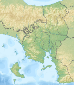
The Isla Jicarita (German island of Klein Jicarón ) is an island in the Gulf of Chiriquí in the Pacific Ocean , which belongs to Panama .
It is located 360 m south of its much larger neighboring island Isla Jicarón , after which it is named. This is located 6.6 km south of Isla Coiba , the largest island in Panama and Central America. Coiba is 53 km to the north and 23 km to the east from the mainland. Jicarita is about 2.6 km long and 0.8 km wide and has an area of just over one square kilometer (Jicarón measures about 20 km²). It extends approximately in north-northwest-south-southeast direction and has a small bay on the east side, about halfway. Like Jicarón with its forest reserve, the island is heavily forested, but the coast is consistently rocky / sandy. On the north-west coast, the vegetation begins partly after 350 m, otherwise earlier. On the east side north of the center, a non-forested strip of land extends about 440 m into the sea.
Jicarita lies entirely in the Coiba National Park , the border of which runs a little less than three kilometers south of the island. Politically it belongs to the province of Veraguas and the district of Montijo . On top of it is a lighthouse, the Faro de Islote Jicarita , which is operated by the Panama Canal Authority. It is 15 m high and has a range of 20 nautical miles (approx. 37 km). Jicarita used to be connected to Jicarón, but erosion formed the channel between them.
According to one definition, the southern tip of Isla Jicarita at 7 ° 12 ′ 13 ″ N , 81 ° 48 ′ 2 ″ W is the southernmost point of North America . It extends about 50 meters further south than the mainland at the Cerro Hoya National Park on the Azuero peninsula , 110 km east. This is no longer true if you include the Costa Rican coconut island or the Colombian island of Malpelo as part of North America, which is closer to Panama than Colombia. Not paying attention to this seems sensible, because both islands are offshore islands and are not on the Caribbean plate , but on the coconut plate . However, if they are counted as part of the continent, the rock Escuba south of Malpelo is the southernmost point of North America. Jicarita would then only be the southernmost point of Panama.
Individual evidence
- ↑ All lengths were determined with Google Maps , the area of Jicaritas with the ACME planimeter .
- ^ The Islands of Coiba National Park: Jicarita , website of the Coiba National Park
- ↑ OpenStreetMap
